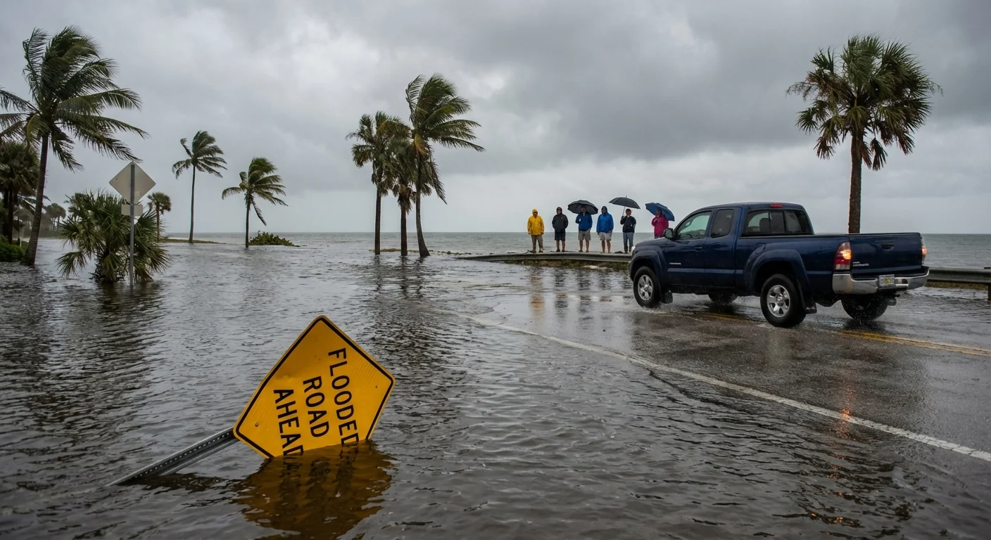
A coastal flood warning is in effect for New York City as a fast moving storm barrels in Friday morning. Strong onshore winds, heavy rain, and a high tide cycle will combine to push water onto roads and into low lying neighborhoods. Expect dangerous surf, spot power cuts, and major travel delays during the morning rush.
The setup and the stakes
This system is compact and quick, but it carries a lot of energy. Winds will ramp up before dawn, then peak through the morning. Gusts may top 50 miles per hour near the water and on bridges. Rain will be heavy at times, with the most intense band sweeping the city around the time of the morning high tide. That timing raises the flood risk.
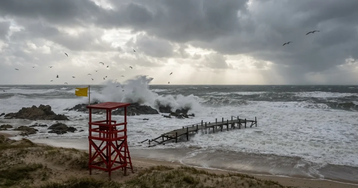
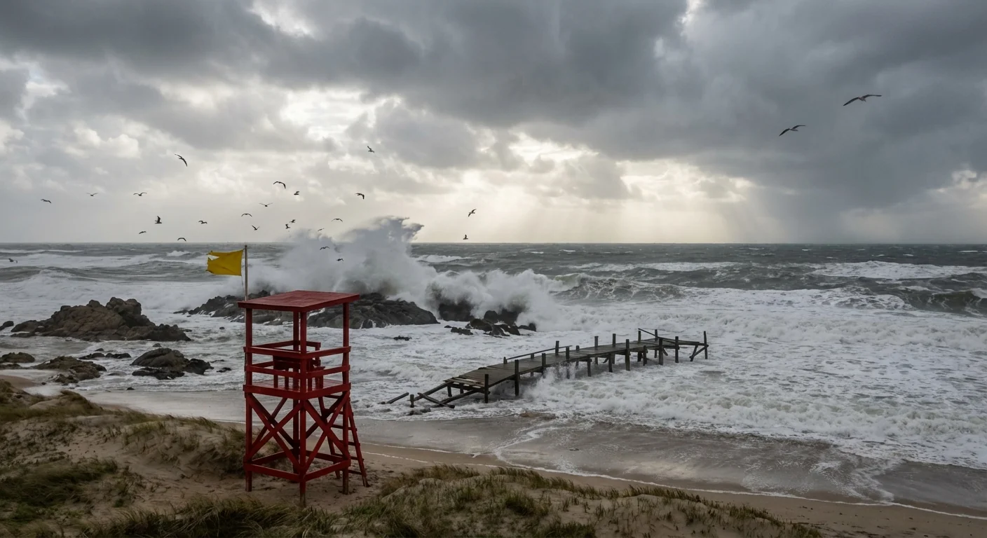
Along the harbor, the East River, Jamaica Bay, and the Atlantic shore, water will pile up against seawalls. Expect saltwater on streets in known trouble spots like the South Shore of Staten Island, Red Hook, Coney Island, the Rockaways, and parts of Lower Manhattan. The Hudson and Harlem River edges may also see spillovers into bike paths and ramps.
High risk window, Friday morning. Greatest coastal flooding at the morning high tide. Avoid shorelines and flood prone blocks. ⚠️
Ocean beaches will see rough surf and strong rip currents. Keep your distance from jetties and piers. Waves can sweep you off your feet in seconds.
What this means for your commute
Plan for a slower, messier morning. Street flooding will block lanes and soak intersections. Ponding near subway grates and station entrances could force closures. Wind may push water up through drains. Ferries and some bridge approaches are vulnerable to spray and debris. Airports can expect delays from low clouds, heavy rain, and crosswinds.
- Subways, bus routes, and commuter rail may face delays, detours, and partial suspensions
- Some bridge and parkway speed limits may drop due to wind and standing water
- Ferries can cancel or reduce service in rough water
- Basement level stations and underpasses are at higher risk for flooding
If you can shift your start time, do it. Work from home if your job allows. If you must drive, pick higher routes and never try to cross a flooded street. A foot of moving water can stall or sweep a car.
Give yourself extra time, extra routes, and extra caution. Do not drive through water. Turn around and choose a safer path.
Neighborhoods on alert
Low lying blocks near the harbor, the East River, and Jamaica Bay face the most direct push of water. Watch for quick rises in places like Howard Beach, Broad Channel, Red Hook, DUMBO, and the eastern and southern edges of Staten Island. On the New Jersey side, Hoboken and Jersey City waterfront areas can see street level flooding that backs up storm drains. Even away from the coast, intense rain can overwhelm local sewers and flood underpasses.
Basement apartments are at special risk. Move valuables and medicines off the floor. Keep a clear exit path. If water begins to enter, get to higher levels fast and call for help if needed.
The climate signal
Rising seas raise the floor for every coastal storm. New York’s water line is higher than it was for our parents, which means less wind and less surge can still flood streets. A warmer atmosphere also holds more moisture, so downpours are heavier. Urban pavement sends that water racing into storm drains that are already stressed by the tide. Put it together, and the same type of storm now delivers bigger impacts.
This is why resilience work matters. Restored wetlands, higher bulkheads, raised electrical systems, and green streets can slow and store water. Every tree canopy and rain garden helps. Today is about safety, but the long game is building a city that can take a hit and keep moving.
What to do right now
Charge your phone and backup battery tonight. Clear leaves from curb drains if it is safe to do so. Bring in or secure outdoor items. Move your car from a flood prone block, especially near shorelines and underpasses. Refill key medicines and check flashlights before the rain starts.
- Avoid waterfront parks, piers, and bulkheads during the morning high tide
- Keep kids away from flooded basements and fast moving water
- Check transit apps and NYC emergency alerts before you leave
- Prepare a small go bag with water, snacks, and chargers
Sign up for city alerts, monitor the National Weather Service, and keep a battery powered radio or app close. Small steps now save time later. 🌧️
The bottom line
Friday morning brings a sharp hit of wind, rain, and coastal flooding. The worst aligns with the morning high tide, then conditions improve in the afternoon as the storm moves away. Respect the water, stay flexible, and look out for neighbors who may need help. We will continue to track water levels, transit changes, and any new advisories. Stay safe, New York.


