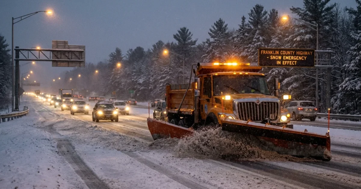
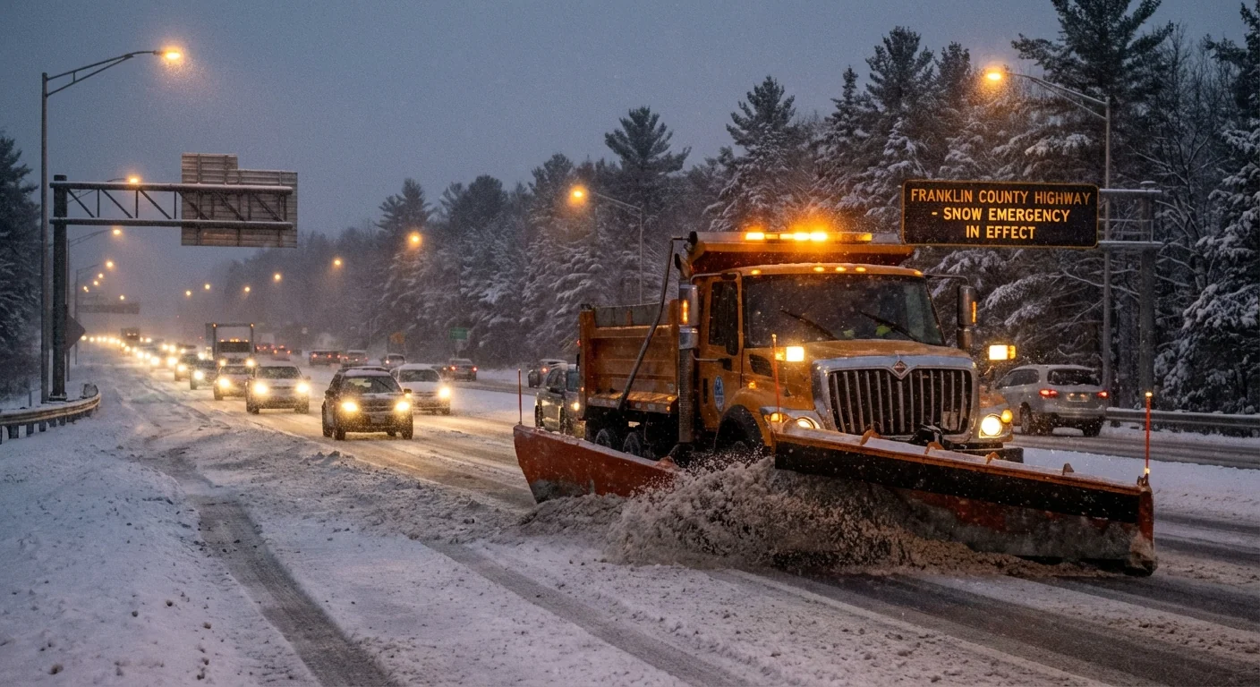
Breaking now. A major winter storm is gripping central Ohio, and travel is turning dangerous by the hour. Franklin County is operating under snow emergency protocols as heavy snow and gusty wind cut visibility and coat roads in ice. Crews are plowing, salt trucks are spreading, and deputies are watching conditions closely. Here is what the county’s snow emergency levels mean, how to check the current status in real time, and why this storm is packing such a punch.
What Franklin County’s snow emergency levels mean
Ohio’s snow emergency system is simple, and it matters. County sheriffs set the level to guide travel and keep roads clear for responders and plows. Levels can rise or fall quickly as bands pivot and temperatures drop.
- Level 1: Roads are icy and hazardous. Drive slow. Crashes and slide-offs are common.
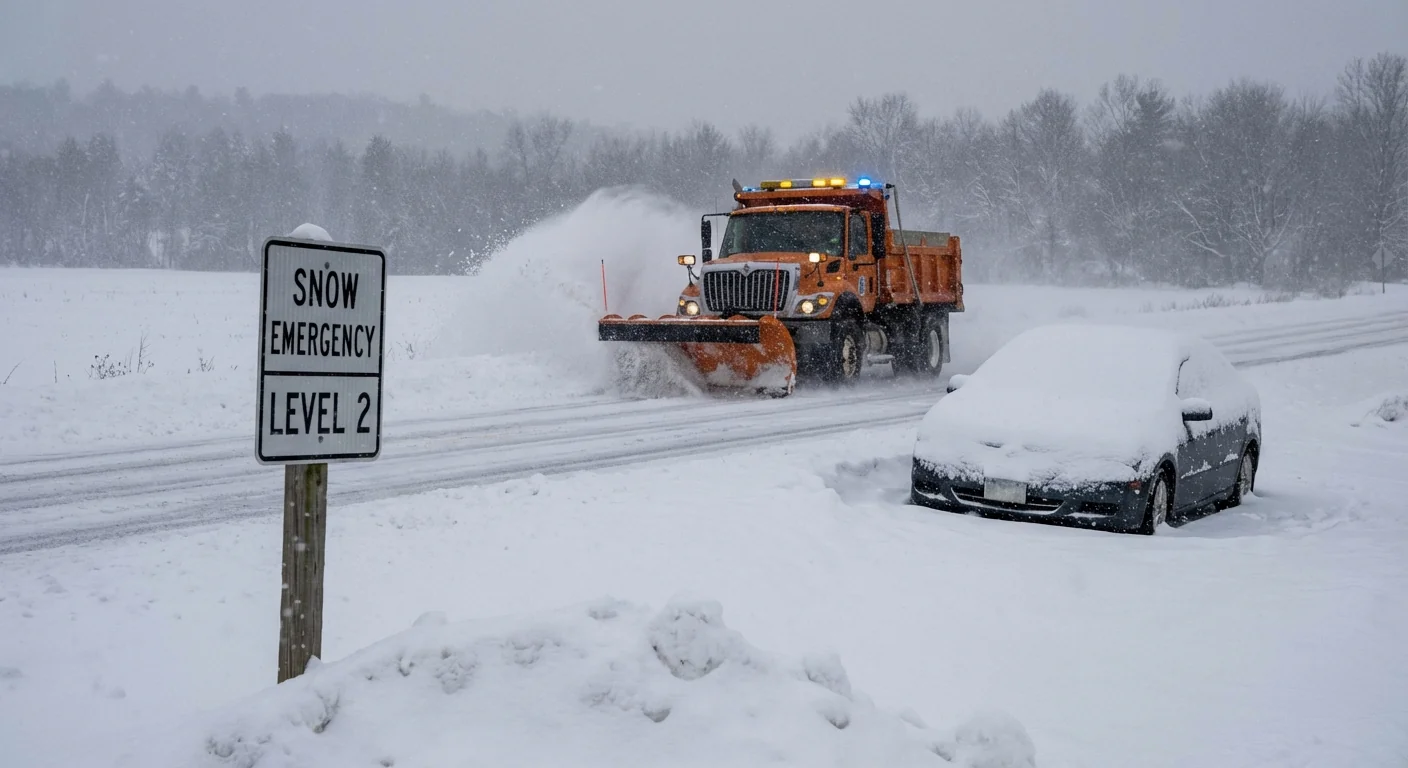
- Level 2: Only necessary travel is advised. Ask if your trip can wait. Many offices switch to remote.
- Level 3: Roads are closed to non-emergency traffic. Stay off the roads unless you are essential staff.
If Level 3 is declared, you can be cited for driving without an emergency need. Keep roads clear for plows and ambulances.
Franklin County includes Columbus, several suburbs, and major interstates. A level change here affects hundreds of thousands of daily trips. Respect the level, even if your street looks passable. Side streets, ramps, and bridges can be far worse than they appear.
What we are seeing on the ground today
This storm is producing long-lasting snow with bursts of heavier rates. Wind is pushing snow back over cleared lanes and dropping visibility fast in open stretches. Temperatures are near freezing, then falling, which makes a quick glaze on untreated pavement. Expect slick bridges, refreezing on shaded roads, and snow-packed neighborhoods.
I am tracking widespread hazards across central Ohio. Plows are making passes, yet snow is re-covering lanes between runs. Interstates move, then slow again as bands pivot. Tonight will be colder, which locks in ice and ruts. Conditions will improve only when snowfall eases and crews gain time to work.
How to check Franklin County’s current status in real time
Conditions are changing fast. The snow emergency level can update at any time. Use official channels before you head out.
- Franklin County Sheriff’s Office, website and official social feeds, for the current level.
- Local TV weather teams, NBC4 and 10TV, for live briefings and county-by-county maps.
- ODOT’s OHGO app and traffic cameras for lane speeds, closures, and plow progress.
- Franklin County emergency alerts for push notifications when levels change.
Bookmark the Sheriff’s Office snow emergency page and the OHGO app. Check both before you start the car.
If your workplace or school has an alert system, make sure notifications are on. Level changes often trigger schedule shifts, remote options, or cancellation of evening events. When in doubt, call ahead and confirm.
Why storms like this are getting trickier
A warmer atmosphere can hold more moisture. When cold air arrives, that extra moisture can fall as heavier snow. Central Ohio sits at a clash point between cold, dry air to the north and milder, moist air to the south. That sharp boundary powers strong winter systems.
We also see more rain to snow flips in a warming climate. Roads get wet, then temperatures slide below freezing, and the glaze sets in. That makes black ice, which plows and salt cannot fix instantly. Wind adds drifting in open areas and packs snow into hard ridges.
Today’s storm fits that pattern. Deep moisture, strong lift, and a wobbly rain snow line early, followed by falling temperatures. The result is a longer window of hazards, not just a quick burst. Staying off the road reduces crashes, protects plow crews, and cuts emissions during peak strain on the grid.
What to do in the next few hours
- Delay all nonessential travel until levels drop and plows clear lanes.
- If you must drive, slow down, leave extra space, and carry a winter kit.
- Shovel early and often. Use calcium chloride or sand, and go easy on rock salt near trees and pets.
- Conserve energy at home. Lower the thermostat a bit, close blinds, and seal drafts.
- Check on neighbors who may need help, especially with sidewalks and heat.
Never run a generator in a garage or near windows. Clear your car’s tailpipe before warming the engine to avoid carbon monoxide buildup.
The bottom line
Franklin County’s snow emergency level can change quickly in a storm like this. Heavy snow, falling temperatures, and wind are making travel hazardous across central Ohio. Know the levels, check the Sheriff’s Office for the current status, use ODOT tools for road conditions, and give plows room to work. Your best move right now, if you can, is to stay put, stay warm, and let the crews do their job. We will continue to monitor conditions and issue updates as they develop.


