BREAKING: Rare Florida Snow, Coast-to-Coast Winter Blast, The Weather Channel Becomes the Nation’s Lifeline
I am tracking a fast-moving winter surge that is rewriting the map today. Snow has dusted parts of Florida’s Panhandle, while a powerful system spreads heavy snow and gusty wind from the Midwest into the I-95 corridor. Conditions are shifting by the hour. Viewers are turning to The Weather Channel for real-time radar, street-level alerts, and clear safety guidance as the freeze lingers.
Florida’s Surprise Snow and a Southern Freeze
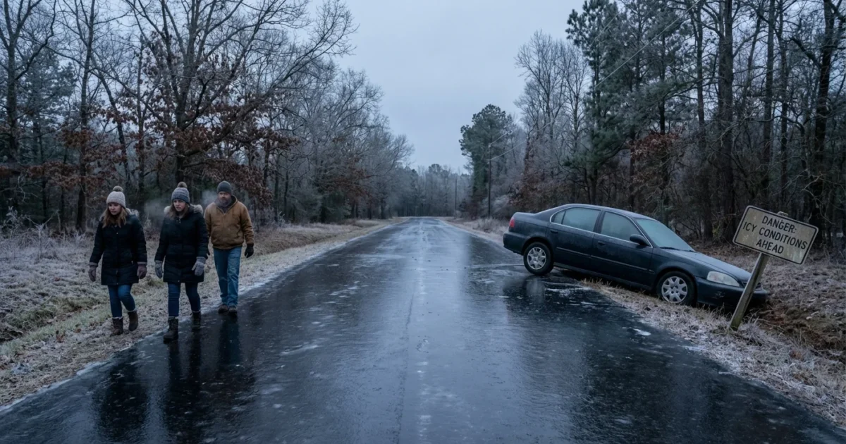
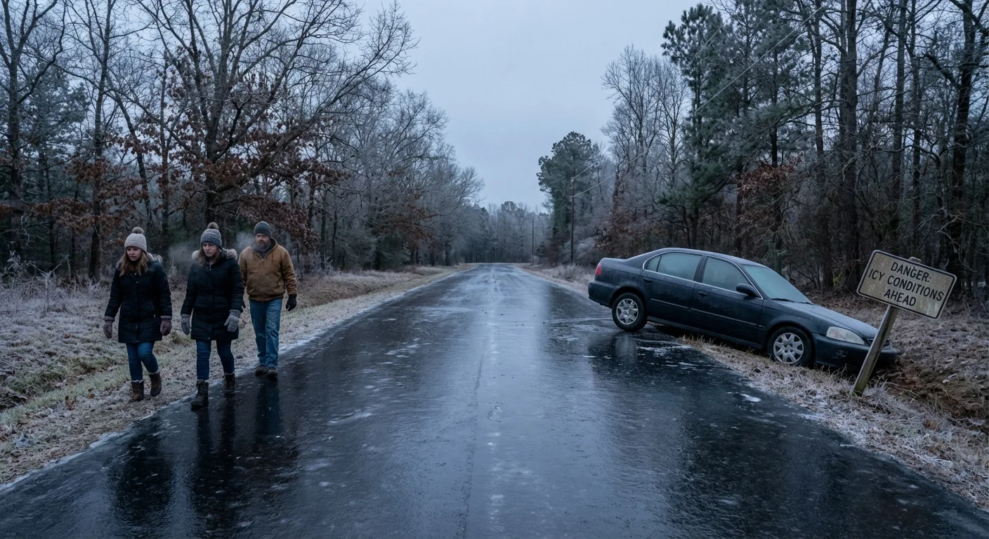
Cold air spilled deep into the Southeast overnight. Light snow and flurries reached parts of the Florida Panhandle, a rare sight for the Gulf Coast. Temperatures have stayed low enough to refreeze wet roads, especially bridges and overpasses. These spots will glaze again at night. Even a dusting can turn dangerous when the ground is warm, then snaps cold.
What happened here is a classic clash. Arctic air sank south. Gulf moisture rode in. Lift and cold overlapped just long enough to make flakes. It is brief, but it is real. Freeze alerts remain active across pockets of the Southeast, and vulnerable pipes, pets, and plants need protection.
Black ice is a serious risk on untreated roads and bridges in the Southeast. Slow down, and avoid travel if you can.
Midwest and I-95, Heavy Snow and Hazardous Travel
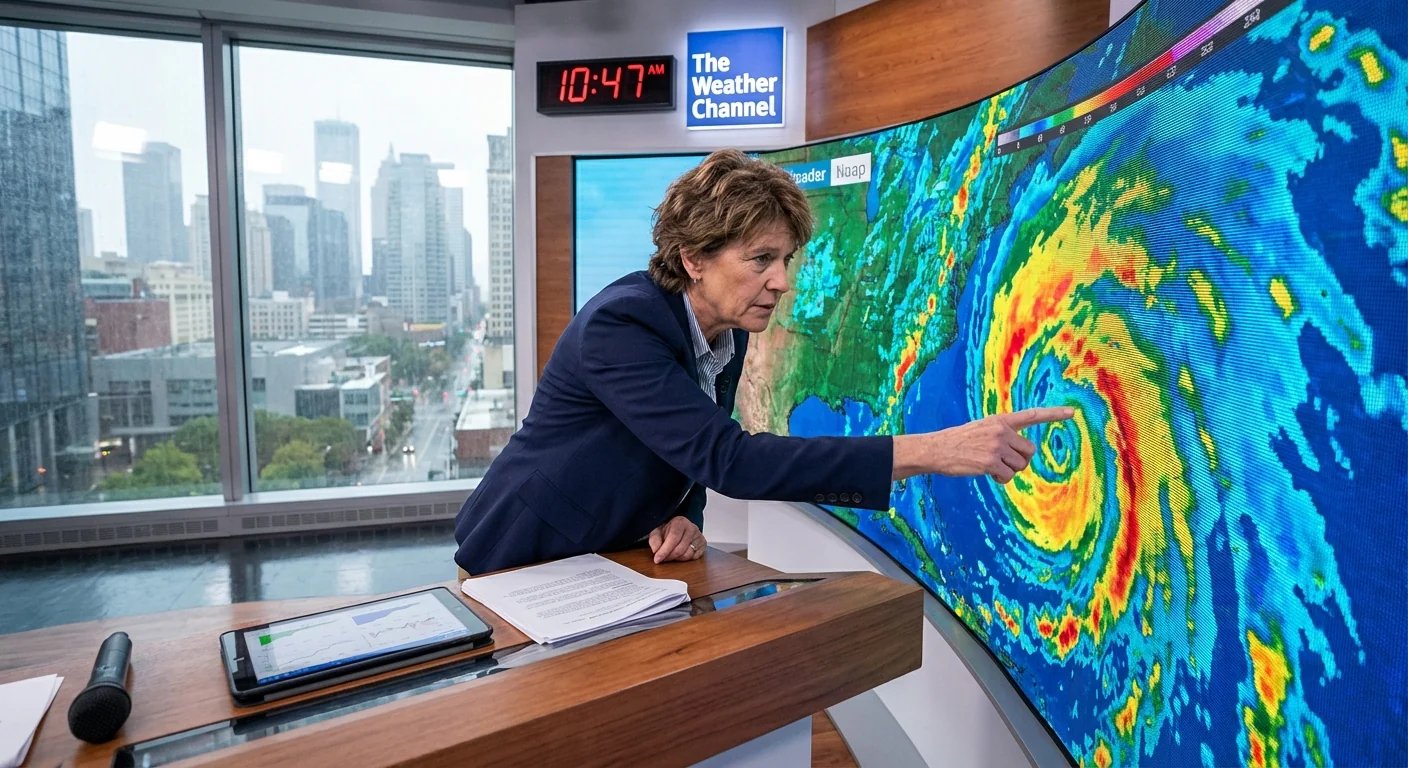
Snow bands are striking the Midwest with bursts of near whiteout, while a strengthening low tracks along the East. The I-95 corridor faces a tight gradient of conditions. That means big snowfall over short distances, slick commutes, and flight disruptions. Winds will drift snow and drop visibility, then temperatures tumble behind the front. Power outages are possible where wet snow clings to lines.
I am watching The Weather Channel’s live radar loops, futurecast tracks, and road impact layers lighting up from the Great Lakes to New England. The coverage shows where the heaviest bands set up, and when they pivot. That matters, because a 20 mile wobble in a snow band can change totals, school decisions, and emergency plans.
Why Real-Time Guidance Matters Right Now
This is a dynamic storm. Mesoscale bands form and fade. A coastal low can draw in Atlantic moisture, then wrap cold air back into the core. In the Midwest, lake enhancement can spike totals near shorelines. You do not need to know the jargon, you need the timing on your block. Hyperlocal alerts, updated hourly, are the difference between a routine evening and a roadside rescue.
Here is what to do in the next 24 hours:
- Check your local forecast every few hours, conditions are evolving fast
- Delay nonessential travel, especially after sunset
- Charge phones and backup batteries before the strongest bands arrive
- Let faucets drip in freezing zones, insulate outdoor spigots
- Bring pets inside, cover tender plants, and check on neighbors
The Climate Signal, Cold Snaps in a Warming World
A warmer planet can still deliver sharp cold shots. The jet stream, a fast river of air aloft, can dip and meander. When it buckles, Arctic air spills south. At the same time, a warmer atmosphere holds more moisture. When cold and moisture line up, storms can produce heavier snow. That is why today’s setups feel intense, even as long-term winter averages trend milder in many places.
Florida’s freeze does not cancel the broader warming trend. It fits a pattern of bigger swings. Heat waves stretch longer. Then, in winter, brief and biting cold can dive south. Planning for both is now essential. Cities and families need resilience that handles extremes on either side of normal.
Seal drafts, add a door sweep, and use heavy curtains. Small steps cut heat loss, lower bills, and ease strain on the grid.
Safe heating is also a climate and health issue. Use space heaters with care, keep them clear of fabric, and never run a generator indoors. Carbon monoxide is silent and deadly. Lowering peak energy use by a few degrees of thermostat reduction, wearing layers, and avoiding oven heating protects both health and the grid.
The Next 48 Hours, Stay Ready, Stay Informed
Expect the storm to shift northeast while trailing cold grips the South and Mid-Atlantic. Some communities will see quick thaws by day, then flash freeze after dark. Snow removal will lag where wind refills roads. River and coastal flooding may arise where heavy snow and rain overlap, especially near clogged drains.
I will continue to track the bands, the freeze lines, and the travel impacts as they evolve. Keep notifications on for local alerts and closures. Use The Weather Channel’s radar and futurecast tools to time your trips and your safety steps. This is a multi-region hit, but smart, steady choices will carry your family through.
Winter is flexing across thousands of miles today. Florida saw flakes. The Midwest and the I-95 corridor are digging out. Stay patient, keep warm, and lean on verified, real-time updates. I am on it, and I will update you as the storm shifts and the freeze settles.


