Flood warnings are now active across three continents, and the stakes are rising by the hour. I am tracking a moisture-laden atmospheric river slamming the U.S. Pacific Northwest, a rapidly deepening North Atlantic storm battering the U.K. and Ireland, and severe convective outbreaks in Saudi Arabia. The common thread is simple. There is too much water arriving too fast, into landscapes already saturated and coastlines facing higher seas.
What is happening now
In the Pacific Northwest, a powerful atmospheric river is funneling tropical moisture into Washington and Oregon. Forecast totals reach about 200 mm, roughly 8 inches, in the lowlands. On the west slopes of the Cascades, some pockets could see 400 mm, near 16 inches. The Skagit, Snoqualmie, and Cowlitz are expected to push toward critical stages through midweek. Landslides are likely on steep, soaked terrain. Travel will be dangerous in mountain passes as rockfall and debris cross roads.
Across the U.K. and Ireland, Storm Bram is driving amber danger-to-life wind and rain warnings for parts of southwest England and Wales. Ireland is under Status Orange wind alerts for multiple counties, with gusts approaching 160 km per hour near exposed coasts. Heavy rain, storm surge, and high tides are stacking the deck for coastal flooding. Dozens of flood alerts and flood warnings are in force, and more are likely as bands pivot over the same areas.
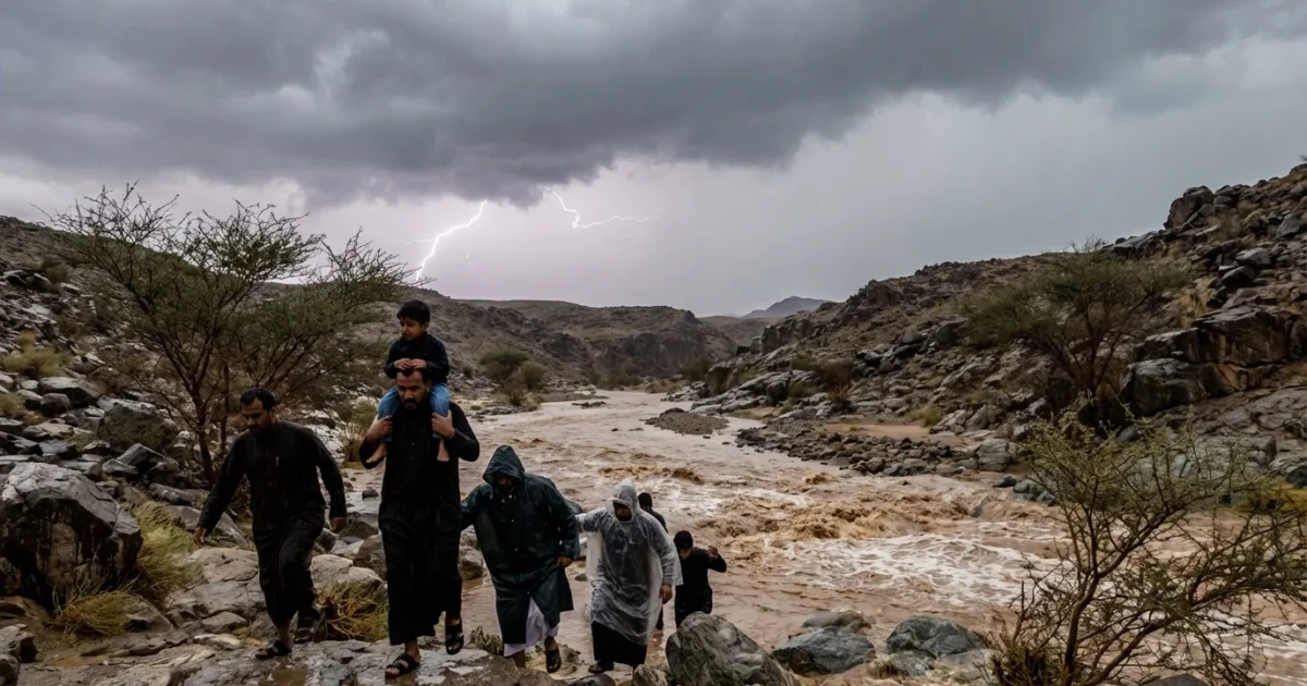
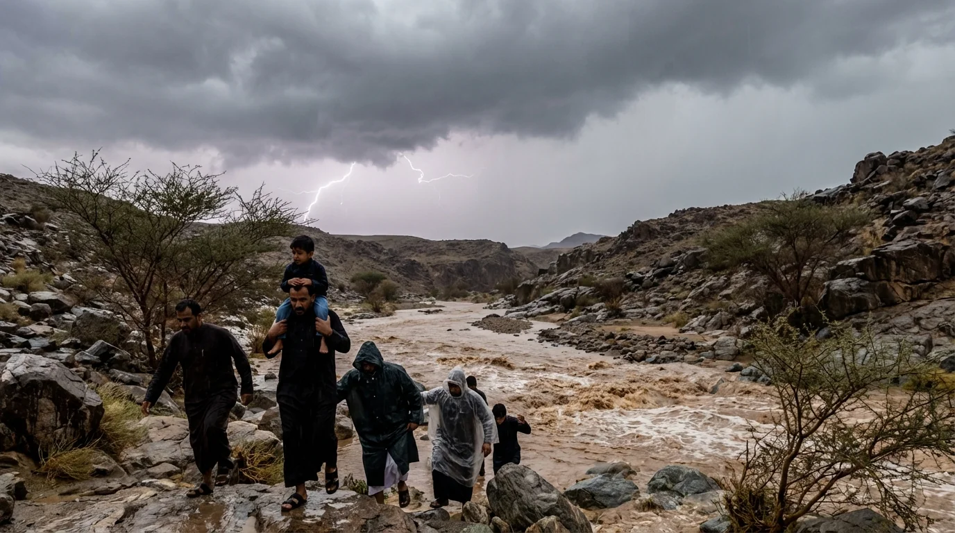
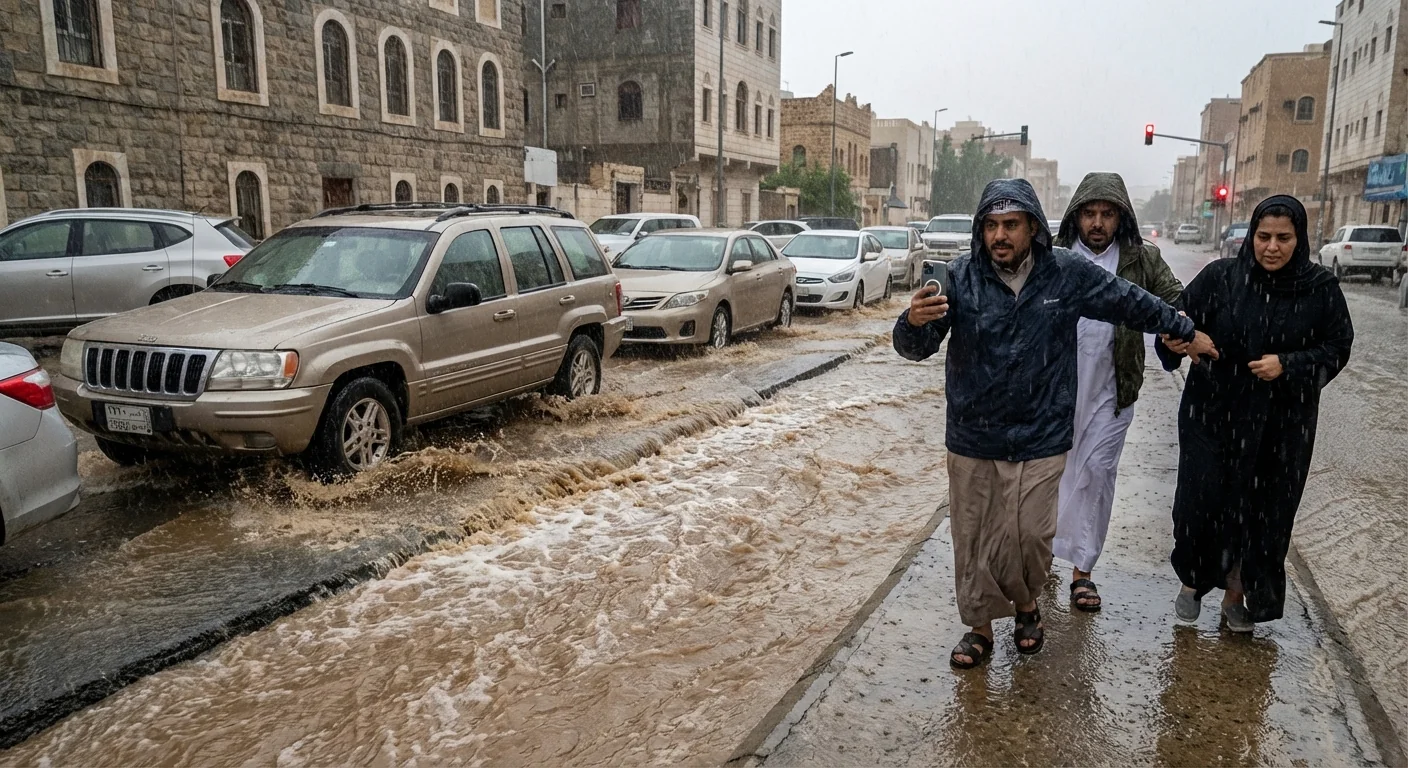
In Saudi Arabia, multi-tier red, orange, and yellow alerts are posted for heavy rain, hail, and thunderstorms. Dry channels can fill in minutes. Flash floods will race through wadis and low crossings with little warning.
The science behind the deluge
Two engines are driving this week’s extremes. Over the Pacific, a long, narrow plume is tapping warm ocean air and steering it into the Northwest. Warmer air carries more water vapor. For every 1 degree Celsius of warming, the air can hold about 7 percent more moisture. That adds fuel to intense downpours.
Over the North Atlantic, a deep low is intensifying quickly, which tightens pressure gradients and ramps up wind. Strong onshore flow piles water toward coasts. Add springy high tides, then wave setup, and surge rises further. On land, saturated soils shed water like a hard surface. Rivers respond faster, and hillslopes can fail. Snow levels are higher in this setup, so more valleys get rain instead of snow. That means more runoff now, and less water stored for later.
Never drive through floodwater. Most flood deaths occur in vehicles. Even 30 centimeters can carry a car. ⚠️
Hot spots and immediate risks
Western Washington and northwest Oregon face the sharpest river rise through the next 24 to 36 hours. Watch the Skagit for rapid climbs, then the Snoqualmie and Cowlitz as upstream runoff arrives. Urban flooding is likely from Puget Sound south to the Willamette Valley where drains clog with leaves. On Cascade foothills, debris flows can start with little notice after cloudbursts.
In the U.K., southwest England, south Wales, and coastal Cornwall are most at risk for combined wind and water impacts. Coastal roads will be hazardous near peak tide. Expect tree damage and power outages as saturated ground lets wind topple roots. In Ireland, counties along the Atlantic rim, including Mayo and Donegal, face dangerous gusts and overtopping waves.
Across Saudi Arabia, the greatest flash flood risk is in urban low spots, wadis, and road dips. Storm cores can drop torrents in minutes. Seek higher ground at the first sign of rushing water.
How to prepare and stay safe
- Charge phones and keep backup power ready.
- Move cars from low lots, never park near streams.
- Clear street drains and downspouts, place sandbags where water enters.
- Pack a go bag with meds, water, lights, and documents.
- Follow local alerts, leave early if advised to evacuate.
Bag it, block it, back up. Pack essentials, place sandbags at entry points, back up data before the power goes.
Building resilience after the storm
Recovery starts before the rain stops. Cities can cut future risk with nature based tools. Wetlands and floodplains store peak flows and lower flood heights. Living shorelines, wider dunes, and mangroves reduce surge and waves. In towns, green roofs, rain gardens, and permeable streets soak up cloudbursts. Updated maps, smarter zoning, and buyouts in the deepest flood zones save lives and money. Early warning systems and community drills turn forecasts into action.


