Chicago locks down for life-threatening cold as schools pivot to e-learning
I am confirming a dangerous blast of Arctic air over the Chicago area and much of the Upper Midwest. Wind chills will plunge well below zero, and conditions will be unsafe for long periods outside. In response, Chicago Public Schools has canceled classes for Friday. Several nearby districts are closing or shifting to e-learning to protect students and staff.
Families should prepare for a full day indoors, slower commutes, and delays across the region. This is a high-impact cold snap with clear risks.
[IMAGE_1]
What is happening right now
An Extreme Cold Warning will be in effect for Cook County. The air mass is bitter and dry, and the wind will stay active. That means exposed skin cools fast. Frostbite and hypothermia are real threats today and Friday morning.
I am tracking the cold push as it spreads across northern Illinois, southern Wisconsin, and parts of Iowa and Indiana. Rail switches can freeze. Buses and cars will start slowly. I expect longer transit times for CTA and Metra, and airport de-icing will add delays. Power demand will spike in the morning and evening as homes fire up heat.
Limit time outdoors. Cover all skin. Check on older neighbors and anyone without reliable heat.
How schools are pivoting
CPS canceled in-person classes for Friday to keep students off icy streets and out of the wind. Many suburban districts are using e-learning plans. Others are closing fully if they cannot guarantee devices, connectivity, or heat at buildings.
Districts are sending alerts with details on meals, tech support, and attendance. If your child’s school uses e-learning, you should act now.
- Confirm the login plan and start time
- Charge devices and gather headsets and chargers
- Look for meal pickup or delivery details
- Watch for special education and support service updates
I have also seen districts prepare warm spaces for essential staff and families who need help. If you are unsure, contact your school office first. District hotlines will be busy, but they can direct you to services.
Why this cold is here
This outbreak is tied to a dip in the jet stream over the central United States. Cold air from the high Arctic has spilled south into the Midwest. When the jet stream buckles like this, Chicago sits on the cold side of the pattern.
Climate science helps explain the bigger picture. The planet is warming, including the Arctic. A warmer Arctic can weaken the temperature contrast that drives a straight, fast jet. That can make the jet wobble more, which sometimes allows cold pools to reach farther south. So we still get sharp cold snaps even as average winters trend warmer. Chicago’s long-term data shows fewer extreme cold days than past decades, but the ones that do arrive can bite hard.
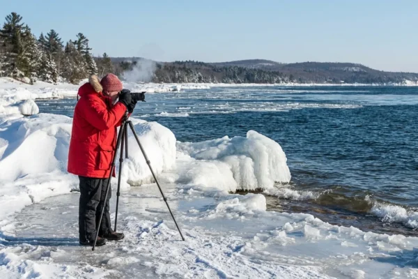
Lake Michigan also plays a role. Air crossing the lake can pick up moisture and drop quick bursts of snow. Blowing snow can reduce visibility and increase wind chill exposure. Even light snow on super cold pavement turns to ice fast.
[IMAGE_2]
Safety, energy, and sustainability
Cold like this tests our homes, our grid, and our choices. The cleanest energy is the energy we do not waste. Small steps today keep families safe and help the region ride out the surge.
Dress in layers, not one big coat. Start with a moisture-wicking base, then add insulation and a windproof shell. Keep a dry backup pair of socks and gloves.
Seal obvious drafts with towels or tape for now. Close curtains at night. Open them when the sun is out to warm rooms for free. Do not use ovens or grills to heat. That is dangerous. If you have a smart thermostat, preheat your home slightly before peak hours, then hold steady. That cuts strain and reduces trips for your furnace.
Electric vehicle owners should precondition batteries while plugged in and keep charge above 30 percent. Gas drivers should top up and keep an emergency kit with blankets, a shovel, and a phone charger. Keep a slow drip on indoor faucets if your pipes run along exterior walls. That reduces freeze risk.
Public works crews are preparing for water main breaks and icy signals. Give them room to work. If you lose power or heat, call your utility right away and move to a warming center if needed. Do not run generators indoors.
The road ahead
The cold will be most dangerous overnight and Friday morning. Wind will ease a bit later Friday. Temperatures should rebound by the weekend, though it will still feel raw. I am watching for a quick clipper and lake effect snow bands that could dust roads and refresh ice.
Schools will update Friday plans by late afternoon. Expect a mix of e-learning and staggered reopenings. Families should keep devices charged and watch district alerts. Commuters should plan for slower service and give themselves extra time.
Extreme cold still happens in a warming world. Today’s blast is a reminder to adapt smarter. Better insulation, modern heating, and strong grid planning protect people and cut emissions. For now, stay inside if you can, layer up if you must go out, and check on each other. I will keep you updated as conditions evolve.


