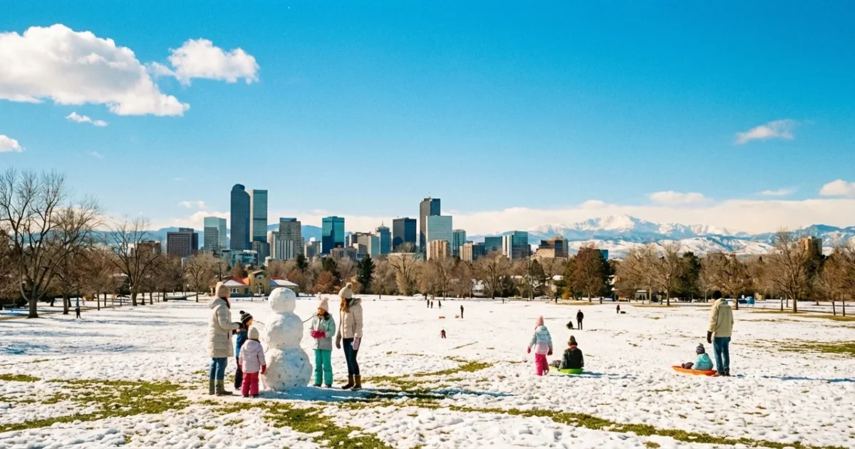
Breaking: Denver heats up in December, with highs today blasting into the 60s and even low 70s across parts of the metro. I am tracking a classic downslope wind event that flipped winter on its head. Winds eased in some neighborhoods this afternoon, but the warm push is holding. Streets are dry. Patios are packed. It feels like April, not mid December.
Heat surges across the Front Range
Warmth built fast after sunrise. As air spilled off the Front Range, it sank toward the city and gained heat. By early afternoon, Denver neighborhoods were posting springlike readings. Some south and west suburbs flirted with 70. Earlier gusts eased for many areas, so the day felt calmer, but the warmth stayed in place.
This kind of day is rare in December. Typical highs are in the 40s, with nights in the teens or 20s. Today’s surge is a sharp break from that. It is short term, but it is notable.
The meteorology, downslope warming in action
How the mountains make heat
Here is the setup. Strong west winds ride over the Rockies. Air rises on the west side, drops moisture, then slides down the east side into Denver. Sinking air compresses and warms. The rule of thumb is about 5 degrees Fahrenheit for every 1,000 feet it falls when dry. That is why a breeze out of the west can turn mild into warm in a single afternoon.
A pressure dip on the plains helps pull that air down. Dry air heats faster. Clear skies add sun power. The mix turns the city into a warm pocket along the I 25 corridor.
Why this stands out in December
Denver can get warm spells any month, but December warmth to this level is unusual. The long term climate signal shows winters warming across Colorado. That background, combined with the right wind pattern, boosts the odds of days like today. There is still year to year swing. Cold snaps will come. Yet the baseline is creeping warmer, which nudges records and stretches the mild spells.
Short term forecast and local impacts
Expect another mild to very warm day in and near Denver through Thursday. Highs will push the 60s again, with a few 70s south of town. Nights stay chilly, so icy spots can refreeze at dawn. A weak front late week could trim highs back into the 50s. Mountain areas see more clouds and a few light snow showers, but the metro stays mainly dry.
Skiers should plan for softer snow on lower runs during the afternoon. Freeze and thaw will glaze shady corners overnight. Urban trails dry out fast, which is great for running, but grasses are crisp.
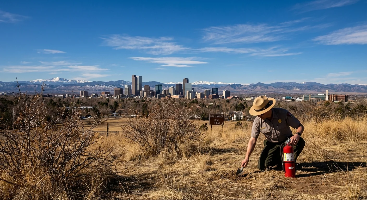
Fire danger rises when warm, dry downslope winds dry out fuels. Avoid any sparks, secure trailer chains, and follow local burn rules.
Climate context
Denver’s December is running hot. Episodes like this fit a broader trend, with Front Range winters warming over the past few decades. Warmer winter days mean more rain at lower elevations during some storms, and less time below freezing. That can thin early season snowpack at the margins and shift peak runoff timing in spring.
Warmth also affects air quality. Downslope events can trap pollution near the surface if an inversion sets up after sunset. Dry soil and fewer snow cover days let the city heat faster on sunny afternoons. The pieces stack, which is why today’s spike matters beyond a single mild day.
What to do today
Use the warmth, but plan smart.
- Start outdoor work early, then take a midafternoon break.
- Ski higher and earlier, then move to shadier runs as snow softens.
- Conserve water, skip lawn watering, and sweep instead of hosing.
- Cut spark risks, keep vehicles off dry grass, and pack out cigarette butts.
Keep a winter ready kit in the car. Warm days can flip to cold nights fast along the Front Range. Layers, water, and a flashlight go a long way.
Conclusion: Denver is riding a December heat wave powered by the mountains and the wind. Enjoy the break from the chill, respect the fire risk, and watch for quick changes. This is the Front Range, where the weather pedal hits the floor and then shifts again.


