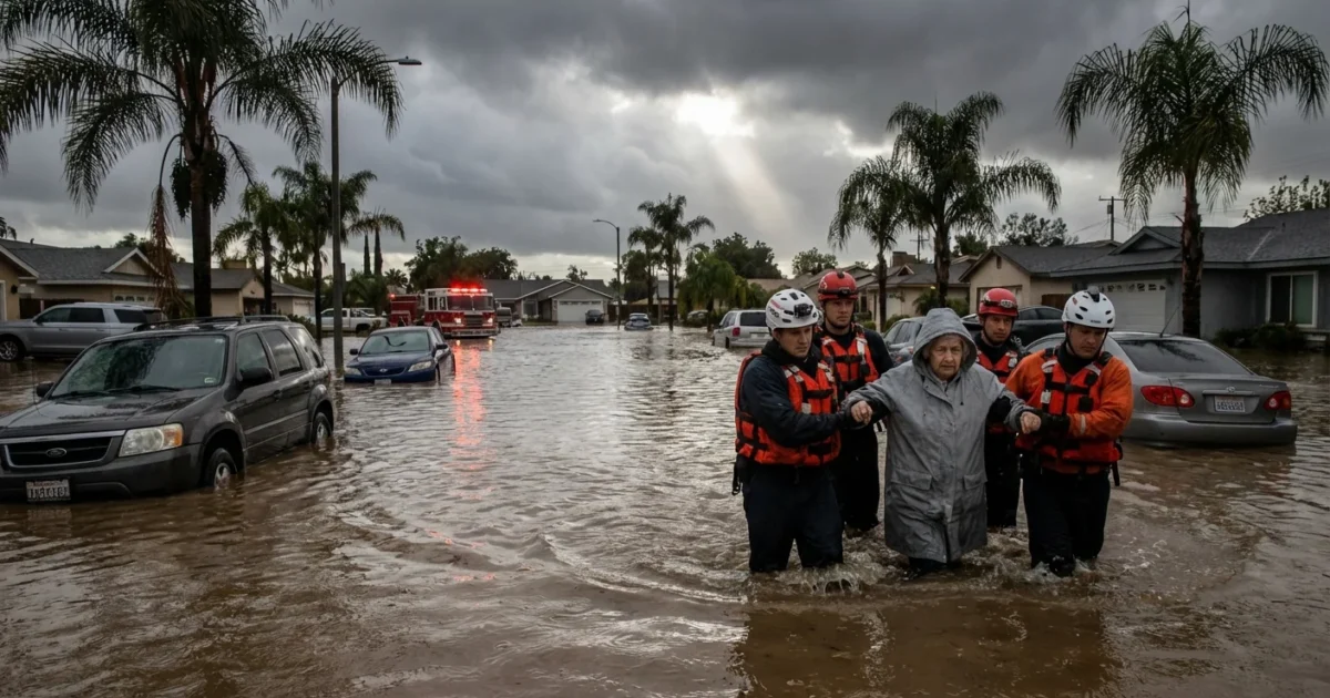
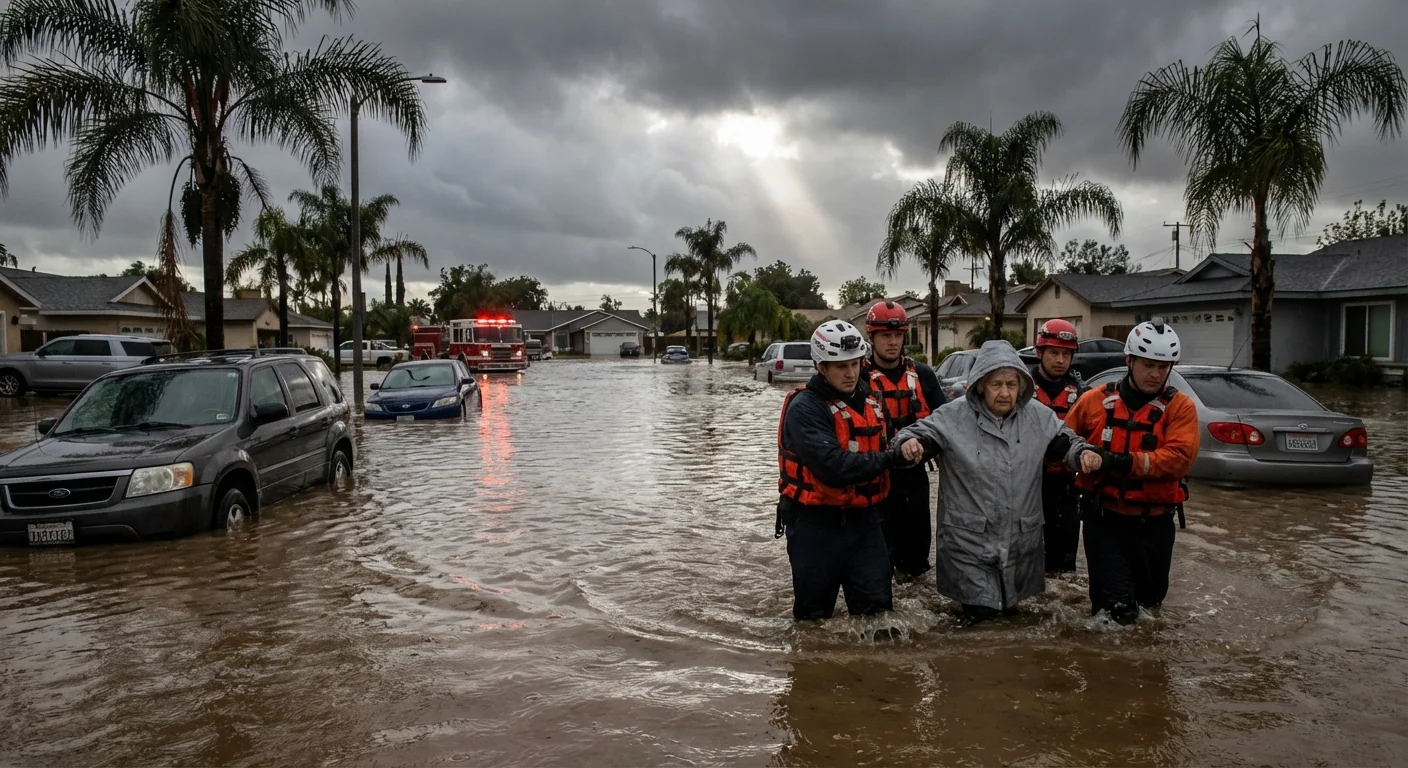
Southern California is under water tonight. A powerful Pacific storm has turned streets into rivers and hillsides into churning slides. I am tracking flash floods from the coast to the foothills, with rescue crews moving swiftly as fresh bands of rain slam the same soaked ground again.
What I am seeing on the ground
Freeways are swamped in several corridors. Low spots filled fast, trapping cars and stalling trucks. Neighborhoods near canyons saw sudden rushes of mud and rock. Debris piled against storm grates and bridges. Water crept up driveways in minutes.
In burn scar areas, slopes failed as rain hammered dry, weak soil. Mud poured across lanes and into yards. Crews are scraping roads clear, only to watch more come down as another burst of rain arrives. Emergency managers have ordered closures where the risk is highest, and some canyon communities have been told to prepare to leave quickly.
How this storm got so intense
This is a classic atmospheric river event, a long band of Pacific moisture aimed straight at Southern California. Warm air is holding more water than a cooler storm would. That means stronger rain bursts. Snow levels are high, so more water is running off instead of locking up as mountain snow. Urban pavement limits drainage. Water has fewer places to sink in, so it races to the lowest point.
Storm energy is also tapping coastal instability. That triggers narrow downpours with rainfall rates that can flood a street in minutes. When these cells train over the same area, flood risk jumps fast.
Warmer air holds more moisture. That gives storms more to work with, which can turn winter rain into dangerous flash floods.
The next 36 hours
This system is not done. Forecasts show more rounds of heavy rain into Christmas Day. The ground is saturated, so even moderate rain can trigger new slides. Rivers and creeks will respond faster than normal. Expect more road closures, scattered power outages, and delays at airports if downpours line up over runways.
Coastal areas could see minor tidal flooding where drains are backed up. Inland valleys remain at risk for urban flash flooding. Mountain routes will face rockfall and low visibility. If you live below a steep slope, watch for cracks in soil, tilting fences, and new runoff paths. Those are early warning signs.

Do not drive through flooded roads. Turn around. Just one foot of moving water can sweep a car off the road.
Travel and safety right now
First responders are stretched across multiple incidents. Help them by reducing risk where you can. Keep your phone charged. Clear leaves from street drains if it is safe. Move cars off flood‑prone streets.
- Avoid underpasses, dips, and low freeway ramps where water collects
- Keep distance from riverbanks and debris choked channels
- Never walk through moving water, even if it looks shallow
- Check official alerts before you travel, then check again before you return
Pack a simple go bag tonight. Include meds, a flashlight, batteries, water, snacks, and copies of key papers.
Why this keeps happening, and what must change
California is built for sunny days, not tropical strength winter bursts. We have miles of hard surfaces that shed water. We also have scarred hills from past fires. These are two forces that speed floods and slides. Climate change is loading the dice for stronger rain events, especially when an atmospheric river taps warm Pacific air. Each degree of warming adds moisture to the air, and that moisture is fuel.
We can adapt. Cities can expand green space, plant urban forests, and build rain gardens to absorb water. Stormwater systems can be upgraded to handle cloudburst style downpours. On slopes, better debris basins and early warning sensors can save lives. Building codes can steer new homes away from known flow paths. These steps are not flashy, but they work.
The bottom line
The emergency is ongoing, and the worst impacts may still be ahead if one more intense band settles over the basin. Keep your plans flexible through Christmas Day. If you are told to leave, go early. If you must travel, choose higher routes and watch for sudden closures. I will continue to track the storm’s path and the flood threat hour by hour. Stay alert, stay patient, and let crews do their work. The rain will end, but the risk from saturated ground and unstable slopes will linger into tomorrow.


