
BREAKING: Lake-effect machine reloading over Lake Erie, Buffalo braces for heavy bands, whiteouts, and ice ❄️
Snow bands take aim at Buffalo
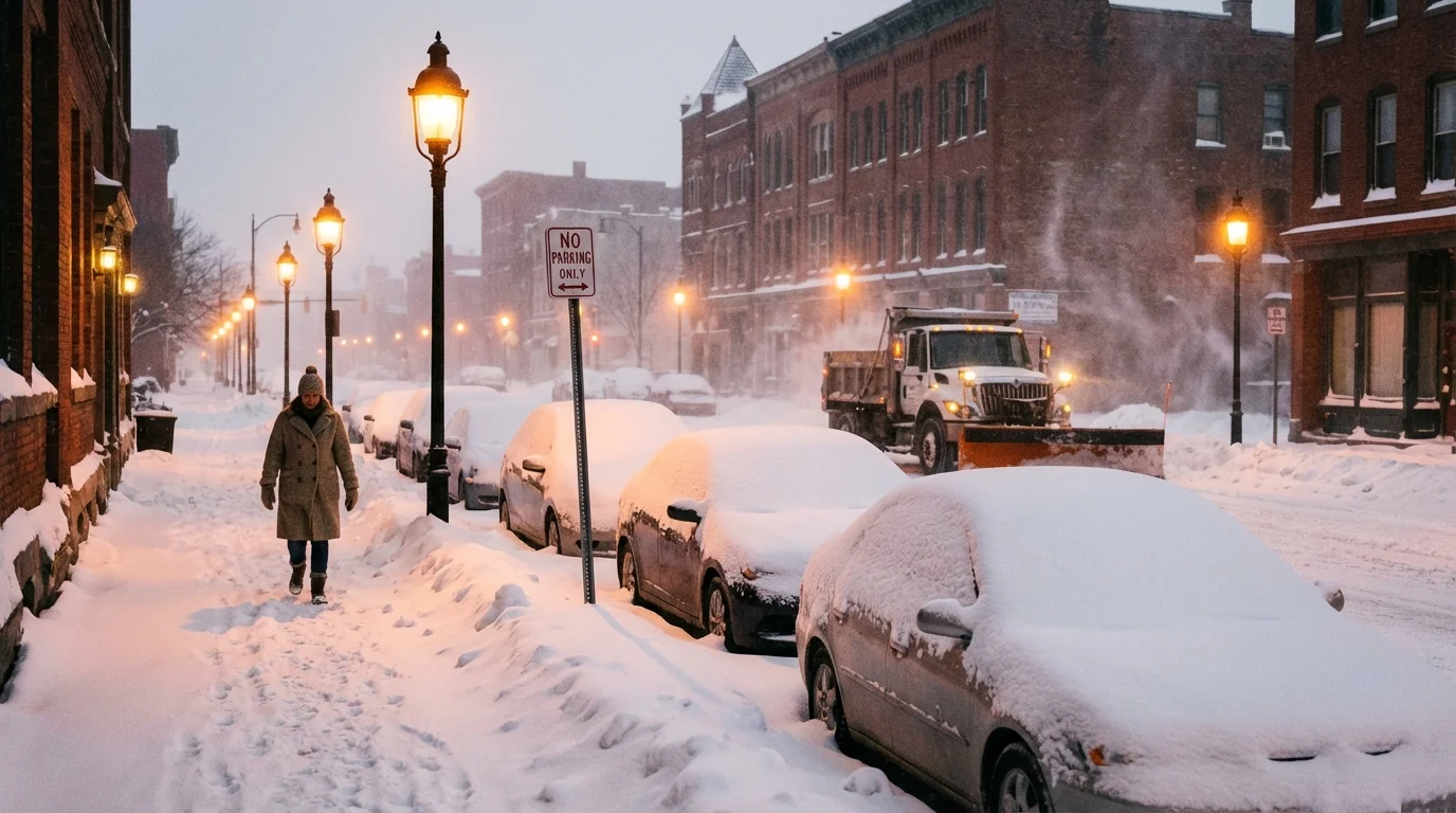
I am tracking lake-effect snow bands forming off Lake Erie this evening. The setup is classic, and it is strengthening. Cold air is flowing across warmer lake water. That adds heat and moisture to the atmosphere. Narrow bands are now organizing and will lock onto the Buffalo metro at times through Tuesday.
Expect intense bursts that flip roads from wet to packed snow in minutes. Visibility will drop to near zero inside the core of a band. Outside the band, it may look quiet. That contrast is the trap.
Timing matters. The most persistent snow targets late tonight through Tuesday morning, with the band wobbling as winds shift. Totals will vary a lot by neighborhood. Southtowns and the ski country could stack up double-digit totals. North of the city may see less if the band holds south. Central New York is also primed for 8 to 14 inches starting Monday, and gusts up to 50 mph are possible in counties southeast of Lake Erie. In the Buffalo area, expect frequent gusts in the 35 to 45 mph range, which means blowing snow and fast-forming drifts.
Cold air plus bursts of snow will ice roads quickly after sunset and near daybreak. Plan on difficult travel for the Monday commute, with periods of whiteout conditions into Tuesday.
Why Buffalo gets hit so hard
Lake-effect snow is a heat engine. Very cold air crosses a relatively warm lake, then rises, cools, and dumps snow downwind. Lake Erie is still warmer than midwinter, and that adds fuel to the storm. The long fetch from the southwest lines up the band into a narrow fire hose. Hills south of the city can squeeze extra snow out of the clouds.
This is also a climate story. Fall and early winter have warmed in our region. Lake Erie stays ice-free longer and holds more heat late into the season. That can boost the intensity of early-season lake-effect events. Year to year snowfall will still swing, but the ingredients for high-impact bursts are more available. Climate change is loading the dice for stronger, shorter, and more erratic bands, especially before the lake freezes.
Whiteouts inside a lake-effect band can be life-threatening. If you cannot see the hood, you cannot see the road. Delay travel when bands are overhead.
What to do right now
If you must drive, treat this as a moving hazard. The band will shift, then return. That means conditions can go from fine to dangerous in one mile.
- Check the latest radar and forecast band position before leaving.
- Leave early, slow down, and increase following distance.
- Keep a winter kit in the car, including scraper, shovel, and warm layers.
- Top off gas, and keep your phone charged in case of detours or delays.
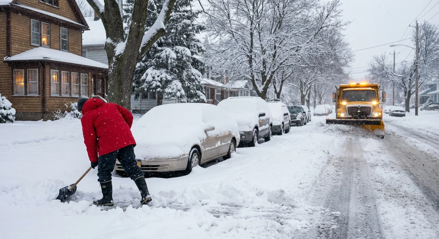
School and work plans may need flexibility. Remote options help during peak band hours. Employers should stagger shifts and allow extra travel time. Plows need room to work. Give them space and avoid passing.
Power outages are possible where gusts top 40 mph, especially with heavy, wet snow clinging to limbs. Secure loose items outdoors. Place flashlights where you can find them in the dark. Never run a generator inside a home or garage.
Charge devices now, set weather alerts on your phone, and park off-street so plows can clear your block faster.
Where to get the most reliable updates
In lake-effect events, small shifts mean big differences. Use trusted local tools, and refresh often.
- National Weather Service Buffalo for warnings, timing, and radar loops.
- New York 511 and NYS Thruway cameras for live road conditions.
- Erie County and Buffalo DPW channels for plow operations and parking rules.
- Your utility’s outage map and text alerts for restoration times.
Sustainability in the storm
Salt saves lives, but it harms streams and soils when used in excess. Municipal crews are increasingly using brine, which sticks to pavement and reduces total salt use. Residents can help too. Shovel early and often, and use just enough salt to break the bond. Clear storm drains so meltwater has somewhere to go when temps bounce above freezing later this week.
The bottom line
Buffalo is entering a high-impact lake-effect window through Tuesday. Expect sudden whiteouts, sharp snowfall gradients, and strong gusts. Prepare for a tough Monday morning and periodic shutdowns of visibility. This is the pattern that defines our winters, now charged by a warmer lake. Take it seriously, stay flexible, and keep your plans weather-smart. I will keep tracking the band movements and will update timing and impacts as the wind shifts. Stay safe, Buffalo.


