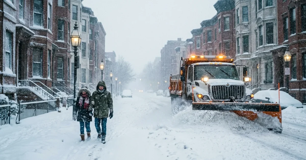
Boston snow totals are surging right now. Thick bands are hammering the city and shifting north and west by the hour. Visibility drops in seconds when the heaviest bursts move through. Plows are out in force. I am tracking the core of the storm as it pivots across Greater Boston this morning, and totals are rising fastest under the stalled snow bands.

Where the snow is piling up right now
This is a wide, messy system with sharp gradients over short distances. A mile can mean several inches. As of this hour, here is the snapshot by region, with the highest amounts where banding is parked:
- Metro Boston, 5 to 10 inches so far, higher where the city saw steady bursts overnight
- North Shore, 8 to 14 inches under a persistent band from Revere to Beverly and inland
- Merrimack Valley and I-495 belt, 10 to 16 inches, locally higher on the hilltops
- South Shore, 4 to 9 inches, lower along the immediate shoreline where mixing cut rates
- Cape and Islands, 1 to 5 inches, higher on the Upper Cape where colder air held
Totals will keep changing through the afternoon as the snow pivot continues. Drifts make measurements tricky. Wind gusts are topping 30 to 40 miles per hour in spots, which lifts and shifts the powder and hides the true depth along curbs and medians.
Totals vary by neighborhood, timing, and exposure to wind. Expect revisions as the storm evolves and tapers later today.
Why your street looks different
This storm is classic New England. It feeds on ocean moisture, then throws narrow, intense snow bands inland. Under those bands, flakes stack up fast. One inch per hour is common. Two inches per hour is possible when the band sits overhead.
A coastal front set up along the shoreline this morning. Just a few degrees of warmer marine air near the surface turned some flakes wetter along the beaches. A few miles inland, the column stayed colder, so totals jumped. The city also holds heat from buildings and pavement. That slows early accumulation downtown, then totals catch up once snowfall rates spike.
Wind direction matters too. A northeast wind steers ocean moisture into Essex and Suffolk counties. When the wind bends more north, the Merrimack Valley lights up. When it tilts east, the South Shore gets the focus. That constant dance is why your friend a town away might shovel twice as much.
How this stacks up with recent winters
Boston winters have shifted in character. There are fewer snow days on average, but when it snows, it can really snow. Warmer ocean waters add moisture to storms. When the air overhead is just cold enough, that extra moisture turns into heavier precipitation rates. That is what we are seeing today, strong lift and deep moisture producing rapid accumulation.
This storm belongs in the top tier of recent events. Not the record books of 2015, but among the biggest in the last several years for widespread impact and high rates. The pattern behind it fits a warming climate. More winter storms now carry tropical moisture streams from the Atlantic. That boosts the ceiling on snowfall for short, intense bursts, even as long stretches of winter trend milder.

Travel, safety, and sustainability
Roads are hazardous in the heavier bands. Snow is light and powdery inland, which blows and drifts across lanes. Near the coast, slushy patches refreeze behind the core of the storm. Expect slick bridges and on ramps through the evening commute. Side streets are rutted where plows cannot keep up.
Travel is dangerous under the strongest bands. If you can, stay off the roads. Give plows room. Whiteouts can hit with little warning.
Shovel early and often to avoid ice layers. Clear hydrants and storm drains on your block. Do not bury crosswalks or bike lanes. Keep exhaust pipes clear if you warm a car. If you use a snowblower, watch for carbon monoxide buildup near garages.
Choose a greener approach to ice control where you can. Oversalting harms pets, plants, and waterways. Try these small changes today:
- Use sand for grip on very cold pavement below 15 degrees
- Switch to calcium magnesium acetate or magnesium chloride blends where available
- Sweep up leftover salt after the storm
Use less salt, and spread it after you clear the snow. A light, even scatter works better than piles and protects the Charles and Boston Harbor.
What comes next
The core band will wobble across the city through midday, then fade west to east by late afternoon. Winds ease tonight. Temperatures drop below freezing after sunset. That sets up a sheet of ice where meltwater refreezes. Expect slick conditions for the morning rush unless salt and sand are refreshed.
I will keep watching the pivot points and updating totals as the storm tapers. For now, the message is simple. Respect the bands. They mean business. Clear what you can, help your neighbors, and give crews space to work. This is a big winter hit for Boston, and it is still unfolding.


