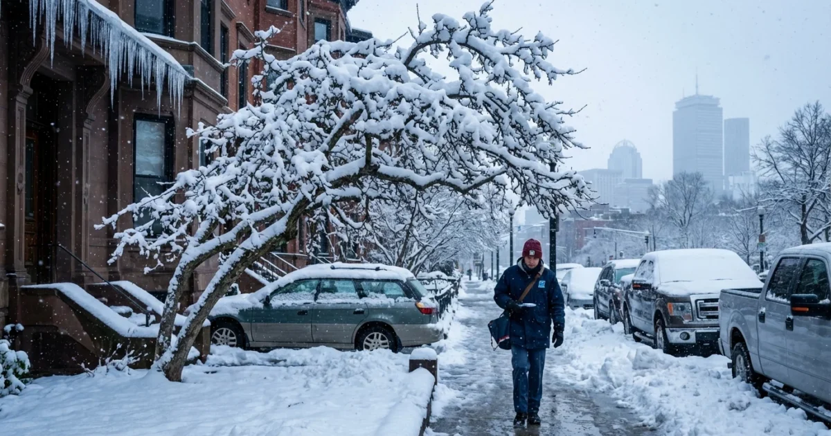
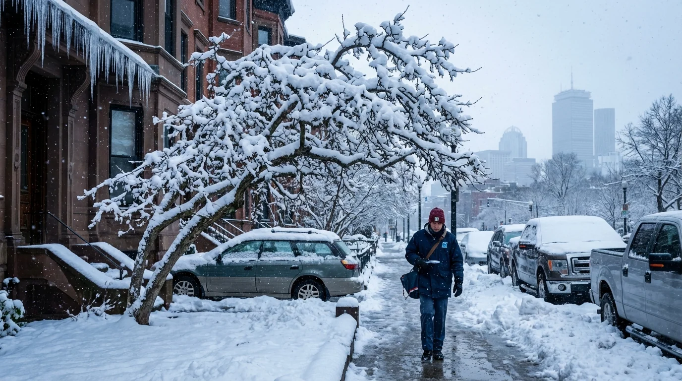
Boston is bracing for a stronger Sunday snow. Fresh model runs early today pushed snowfall totals higher across the city and suburbs. Expect steadier snow, slower roads, and sharp visibility drops. This is a fast-changing setup, and it just got more impactful. ❄️
Why the totals went up
The storm path ticked closer to the coast overnight. That small shift matters. It pulls deeper Atlantic moisture over colder air sitting above eastern Massachusetts. More moisture plus just-cold-enough air leads to heavier bands and quicker accumulation.
A coastal front is likely to form near the shoreline. On the city side of that boundary, air stays colder. Snowflakes fall fatter. Totals rise. Farther south and along the immediate harbor, brief mixing is still possible. The closer track also boosts lift in the low and mid levels. That supports narrow snow bands with bursts of 1 inch per hour. If a band stalls over a neighborhood, totals jump.
The ocean is warm for January. That adds water vapor to the storm. It does not guarantee rain. With surface temps near or below freezing in Boston’s urban canopy, much of that moisture converts to snow. The result is a wetter, heavier snow that clings to branches and wires.
Timing and impacts across the city
Snow spreads into Greater Boston late Saturday night, then intensifies Sunday morning. The heaviest window runs from pre-dawn through early afternoon. Expect the plows to be active and visibility to fall quickly in snow bursts. Roads will be slick, especially on bridges and untreated side streets.
Gusts will run stronger along the coast. That raises the risk of blowing snow and short-lived whiteouts near open areas and on higher ramps. The city core may see a brief mix near the end of the storm, but colder pockets across Boston neighborhoods should stay mainly snow. Commuters and crews will feel the weight of this storm from curb to curb.
Travel will be hazardous during the Sunday morning push. Plan for delays, scattered spinouts, and a small risk of isolated power issues where heavy, wet snow collects on limbs.
What this says about our climate
Boston’s winters are warming. That trend cuts the number of small snow days. It does not remove big snow. When cold air lines up with a moisture-rich Atlantic, storms can overperform. A warmer ocean loads the atmosphere with more water. That means heavier precipitation when it does snow.
We also see sharper gradients. One part of the city can have plowable snow while another taps milder air and mixes. This storm shows that split. The rain snow line fights to move north, but shallow cold near the surface can win in Boston’s dense streets, parks, and low spots. Big picture, New England gets fewer light events and a higher share of heavy, high-impact ones. That is a hallmark of a warming climate.
How to prepare and cut your footprint
If you can, shift errands today and early tonight. Give city crews space on Sunday and avoid nonessential driving during the heaviest snow. Keep sidewalks clear and drains open. That protects neighbors and helps runoff when melting begins.
- Shovel in stages so the snow does not compact and strain your back.
- Go easy on salt. Use sand on cold spots and save waterways from extra chloride.
- Clear storm drains and hydrants near your home.
- If you must drive, slow down and leave extra room.

Warm your home wisely. Close drafts, use heavy curtains, and keep thermostats steady. Small steps lower bills and cut emissions while you ride out the storm.
What I am watching next
I am tracking the exact placement of the coastal front and any narrow snow bands. A 10 mile wobble will change totals between downtown, Dorchester, and the North Shore. I am also watching for a brief mix near the harbor late in the event. If colder air holds longer than expected, snow ratios will rise and totals climb.
Road temps and traffic will matter. Early plow passes will help, but heavy bursts can overcome treated surfaces for a time. Expect quick changes by neighborhood. I will update through the morning with fresh radar trends and ground reports. Keep notifications on for official alerts as the storm evolves.
In short, Boston’s Sunday just got snowier. The city is set for a plowable, disruptive event with the most intense period centered on the morning. Respect the roads, check on neighbors, and clear those drains. This is winter in a warming world, loaded with moisture and capable of sharp surprises. Stay safe, stay patient, and I will keep you ahead of every turn.


