BREAKING NOW: Heavy Snow Aims at Greater Boston, Major Monday Disruptions Likely
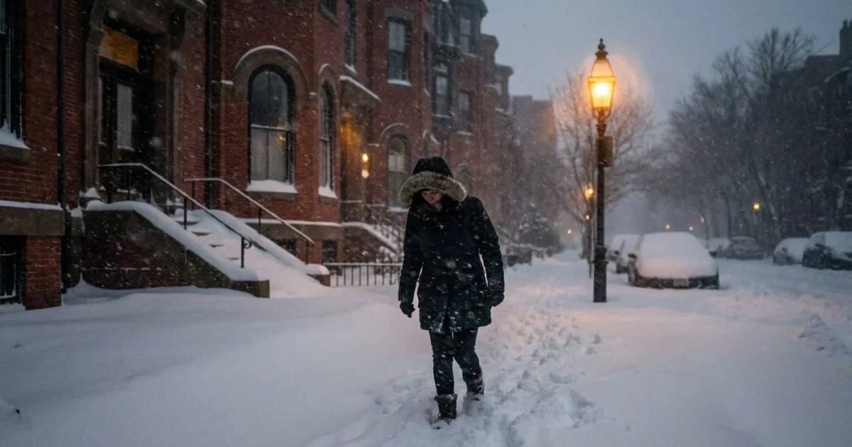
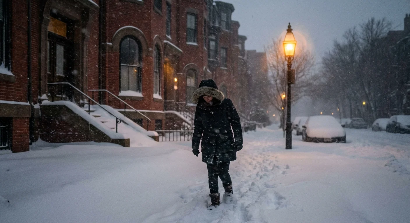
I am tracking a strengthening winter storm pushing into Greater Boston tonight. Snow builds late this evening, turns heavy overnight, and will slam the Monday morning commute. Travel will be slow and risky. Plows will be active before dawn. Expect widespread schedule changes and delays across the region.
This is a classic New England setup. Cold air is locked inland. Moist ocean air feeds the storm from the southeast. That mix points to higher totals north and west of the city, with a slushy mix possible on the immediate coast. Plan for a tough start to Monday.
Hazardous roads and low visibility are likely during the Monday morning commute. If you can, delay travel. ❄️
Timing and What to Expect by Area
Snow arrives from southwest to northeast late Sunday, mainly after 8 p.m. It intensifies after midnight. The peak comes from about 2 a.m. to late morning Monday, with bursts of heavy, wet snow. Bands will wobble, but the trend is clear. Tapering begins midday, with light snow or drizzle into the afternoon.
Inland and Higher Terrain
North and west of I-95, including the I-495 belt and the hill towns, colder air holds. That supports steady snow with periods of heavy rates. Roads turn snow covered overnight. By late Monday morning, many inland towns will be digging out from a significant accumulation, with plowable totals.
Boston and the Coast
Boston, the North Shore, and the South Shore sit on the razor’s edge. Snow starts early, but ocean air can nudge temperatures near freezing. A mix with sleet or rain is possible at the shoreline, especially Cape Ann and the South Shore. That may trim totals right on the water, but it also makes the snow heavier. Side streets will still be slick.
Winds increase along the coast, which leads to blowing snow and brief whiteouts in heavier bands. Visibility will drop fast during bursts.
Commute and School Disruptions: Plan Your Monday
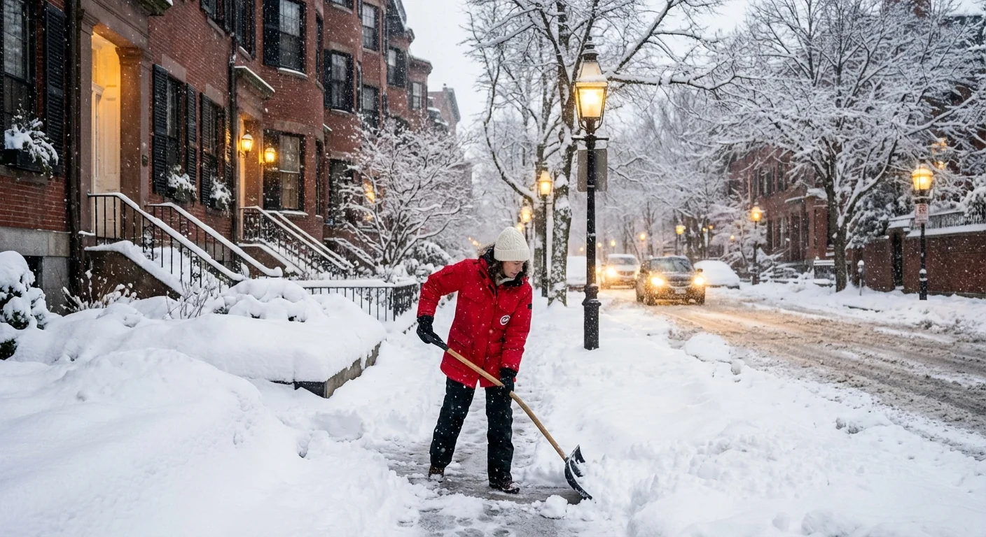
Plows will target main roads first, but side streets will lag. Transit delays are likely as crews clear tracks and switch points. Many schools are moving to closures or delays. Parents should check district updates tonight and again before dawn. Employers should expect late arrivals and remote work requests.
If you must travel Monday morning, slow down and leave extra space. Watch for snowbanks at intersections. Pedestrians and cyclists face hidden ice near curb cuts. Bus stops may be buried.
- Check alerts by 5 a.m., including transit and school updates.
- Clear exhaust pipes on vehicles before starting the engine.
- Shovel in short bursts to avoid strain, the snow will be heavy.
- Give plows room, never pass during active clearing.
- Rinse boots and paws, road salt is harsh on skin and pets.
Clear storm drains near your home. It reduces street flooding when snow changes to drizzle or melts. Keep salt use light, a coffee cup per 10 sidewalk squares is enough.
The Climate Signal Behind This Storm
This storm taps warm ocean water, which holds more heat now than our grandparents’ winters. Warmer seas send more moisture into the air. That moisture wrings out as heavier precipitation. In today’s setup, cold air inland turns that moisture into deep snow. Near the coast, the extra heat pushes temps toward freezing, which causes mixing.
New England’s winters are trending warmer overall, yet the heaviest snow events can still be very intense. That is the paradox of a warming climate. Fewer snowy days, but bigger bursts when the pattern lines up. The Northeast has already seen a rise in heavy precipitation events over recent decades. That means wetter storms, more slush near the shoreline, and heavier, backbreaking snow inland.
Heavy, wet snow loads trees and lines. Isolated outages are possible. Charge devices tonight and keep batteries ready.
Prepare Smart, Prepare Green Tonight
You can get ready without wasting energy or polluting waterways. Lay out gear, charge devices, and stagger travel. Keep your home safe and your street passable.
- Bring shovels and sand to the door, not rock salt if you can avoid it.
- Set thermostats to a steady, safe temperature. Avoid big swings.
- Park off-street if possible, to help plows clear the curb.
- Check on elderly neighbors and those without reliable heat.
Generators should stay outside, far from windows. Never run them in garages. If you have to salt, use less and sweep up leftovers after the storm. Clear hydrants and crosswalks when safe. Small actions help emergency crews and keep runoff cleaner when melting begins.
The Bottom Line
Snow surges into Greater Boston late tonight and hits hardest through Monday morning. Inland areas should expect plowable totals and slow travel. The coast may mix, but will still see slick roads and heavy, wet snow. Climate change is loading storms with more moisture, turning the dial toward heavier bursts. Prepare now, travel later if you can, and keep your plan simple. I will keep tracking the bands and the mix line through the morning. Stay safe, and take it slow.


