
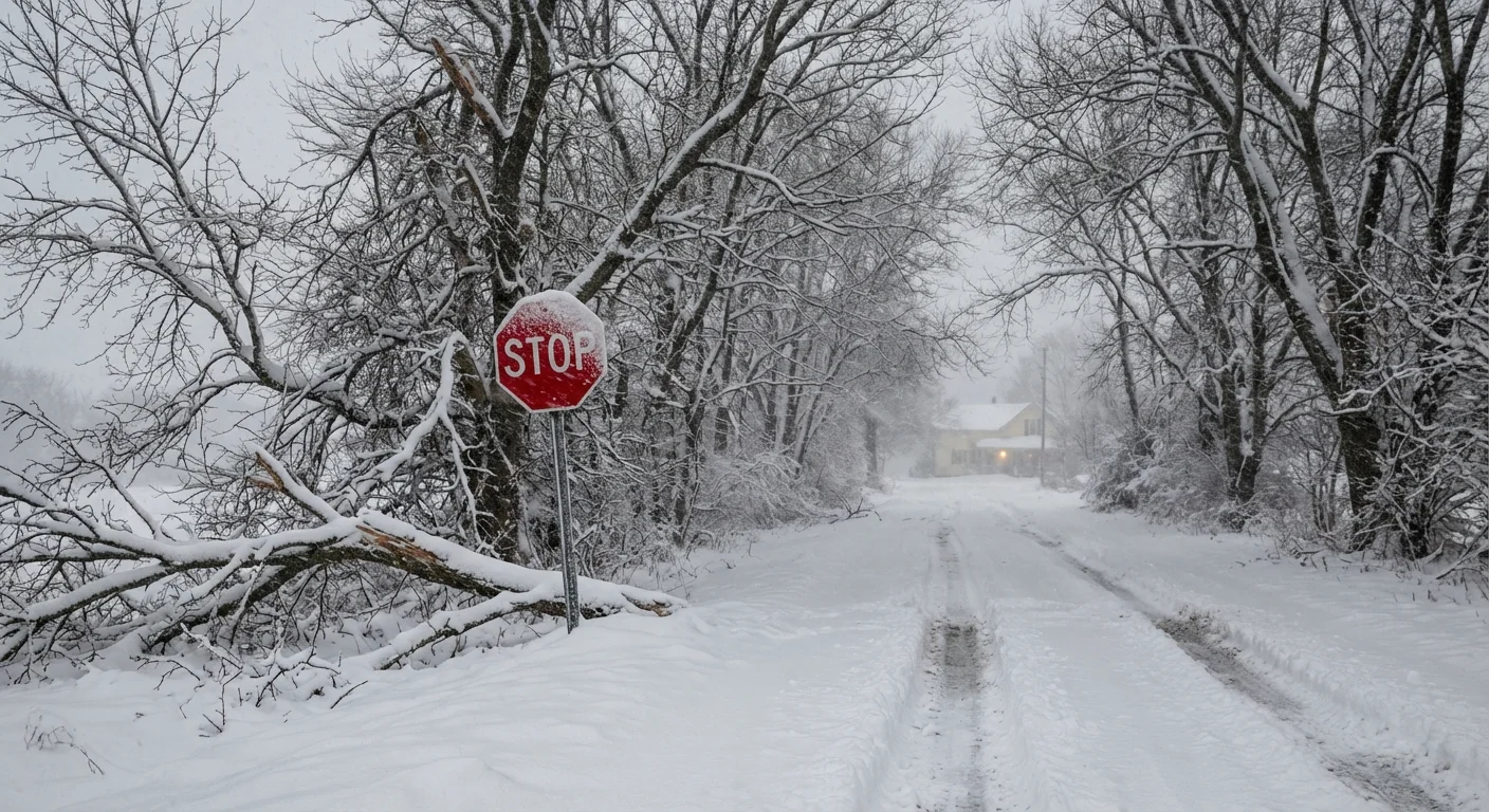
A fierce winter storm is exploding in strength tonight. This is a classic bomb cyclone, and it is already disrupting holiday plans. Heavy snow, blinding wind, and dangerous cold are spreading from the Upper Midwest to the Northeast. Travel will be slow, risky, and in some places impossible. ❄️
A dangerous storm is rapidly intensifying
The storm is deepening fast, which means the air pressure is falling quickly. That rapid drop is the red flag. It tightens the pressure gradient, which cranks up wind speed and pulls in moisture. Snow totals are already stacking up in parts of Minnesota, and bands are expanding east through Wisconsin and Michigan. Whiteout bursts are moving with the strongest bands, and drifting is beginning on open roads.
Expect airports to slow, then stop, as visibility drops. Expect roads to close for plow operations, especially in rural corridors. Power outages are possible where wet, heavy snow clings to lines and where gusts topple tree limbs.
What a bomb cyclone means
A bomb cyclone is not a myth. It is a storm that deepens by about 24 millibars in 24 hours. When that happens, winds roar, and precipitation ramps up. The core of this system is tapping Gulf and Atlantic moisture, which feeds intense snow bands. North and west of the track, snow is dry and powdery. Near the rain snow line, it turns heavy and wet. Along the coast, onshore winds raise the risk of coastal flooding at high tide.
How the pieces fit
- Fast deepening lowers pressure, which accelerates wind.
- Strong wind drives ground blizzards, even after the snow ends.
- Warmer waters add moisture, which boosts snowfall rates.
Who is in the path and what to expect
Upper Midwest and Great Lakes
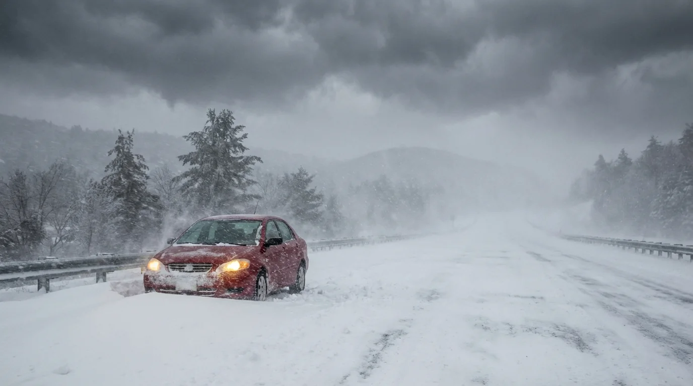
Minnesota, Wisconsin, northern Iowa, and the Dakotas are in the teeth of this storm tonight into Monday. Look for rapid drops in visibility, near zero at times. Gusts can reach highway-stopping levels, and plows will struggle where roads drift back in minutes. Across the Great Lakes, shoreline flooding and heavy lake effect bands will flare once the main low pulls away. Travel could remain dangerous after the main snow ends due to blowing snow.
Interior Northeast and coastal zones
Interior New York, Vermont, New Hampshire, and Maine are set for long-duration snow with periods of blizzard conditions. The I 95 corridor faces a messy mix, with a quick flip between rain, sleet, and wet snow possible. Coastal counties face pounding surf and minor to moderate flooding at high tide, driven by persistent onshore winds. Expect scattered outages where heavy, wet snow meets strong gusts.
Blizzard conditions mean low visibility and strong winds, not just heavy new snow. Do not drive when whiteouts are active. Turn back if you cannot see the road.
Why this storm is supercharged
This storm is textbook, but the fuel is modern. Ocean temperatures along the East Coast are running warm for the season. Warmer water adds extra moisture to the air, which can supercharge snowfall rates. A warmer atmosphere holds more water vapor, roughly seven percent more per degree Celsius. That extra moisture falls out as heavier rain or snow when a strong system arrives.
The jet stream is also intense right now. A sharp contrast between cold Arctic air and milder southern air is steering a deep trough into the Midwest. That setup favors rapid deepening, which matches what I am tracking. Climate change does not cause a single storm, but it loads the dice. It can amplify the water supply, shift storm tracks, and extend the season for heavy, wet snow that breaks trees and lines.
How to travel and prepare safely
If you can, delay non essential travel until the back side of the storm clears. If you must go, plan for zero visibility and sudden drifts. Check airline and rail alerts before you leave home. Have a backup plan if a closure traps you overnight.
- Keep a winter kit in the car, with warm layers, water, food, and a phone charger.
- Top off fuel, and keep your phone charged to receive emergency alerts.
- At home, prepare for outages with flashlights and a safe heat plan.
- Clear storm drains to reduce street flooding as snow changes to slush.
Tell someone your route and expected arrival time if you travel. If conditions worsen, exit safely and wait it out.
Building resilience after the storm
This is a wake up call during peak holiday travel. Communities can cut risk by hardening the grid, expanding tree maintenance, and raising coastal defenses in flood prone areas. Better snow storage, smarter plow routes, and heated critical sidewalks keep life moving for those who must work. Households can improve insulation, seal drafts, and consider heat pumps and backup power to ride out future storms. Local governments can add green infrastructure that soaks up meltwater, which lowers flood risk when a quick thaw follows.
This bomb cyclone is here, and it is still intensifying. If you are in the path, act now. Shift plans, prepare, and stay connected to official local forecasts and alerts. I will keep tracking the pressure falls, the wind field, and the snow bands. Stay safe, and let the storm pass before you do. ⚠️


