A rapidly intensifying coastal storm is taking shape for the East Coast this weekend. The setup favors heavy snow for some, wind for many, and coastal flooding that could bite at high tide. Small shifts in the storm track will decide everything, from slushy roads to shutdown travel. This is a high impact pattern, and the window to prepare is now.
A fast deepener over warm water
Forecast models are locking in on rapid cyclogenesis offshore late Friday into Sunday. That means a surface low pressure system will strengthen fast over the Atlantic. If pressure drops 24 millibars in 24 hours, it meets the bomb cyclone mark. Warm ocean water and sharp temperature contrasts are the fuel. A strong jet stream overhead provides the spark.
This combination supports a classic nor’easter setup. Moisture streams in from the ocean. Cold air tries to hold near the surface. That mix can produce heavy, wet snow inland and wind driven rain at the coast. Seas build quickly, so marine conditions will turn dangerous.
The track will decide who sees snow
The storm’s exact path will set the rain snow line, especially along the I-95 corridor from Washington to Boston. A shift of even 50 to 100 miles could flip outcomes. Here are the leading scenarios we are tracking:
- Closer to the coast, milder air noses inland. Expect heavy rain near I-95, with heavy wet snow over the interior hills.
- Near the benchmark just southeast of Cape Cod, colder air locks in. A swath of heavy snow can reach I-95, with strong winds and power outage risk.
- Farther offshore, impacts shrink. Windy, colder, but lighter snow bands, mainly east of the big cities.
- A delayed phase, slower start Friday night. That would push the worst into Saturday night and Sunday morning.
A track shift of 50 to 100 miles can flip rain to heavy snow along the I-95 corridor.
Heavy, wet snow would load trees and wires where surface temperatures hover near freezing. That raises outage risk in the Appalachians, the interior Mid Atlantic, and interior New England. Near the coast, the risk leans to flooding at high tides and beach erosion.
Heavy wet snow on trees and wires raises outage risk, especially inland hills from Virginia to interior New England.
Timing and hazards through the weekend
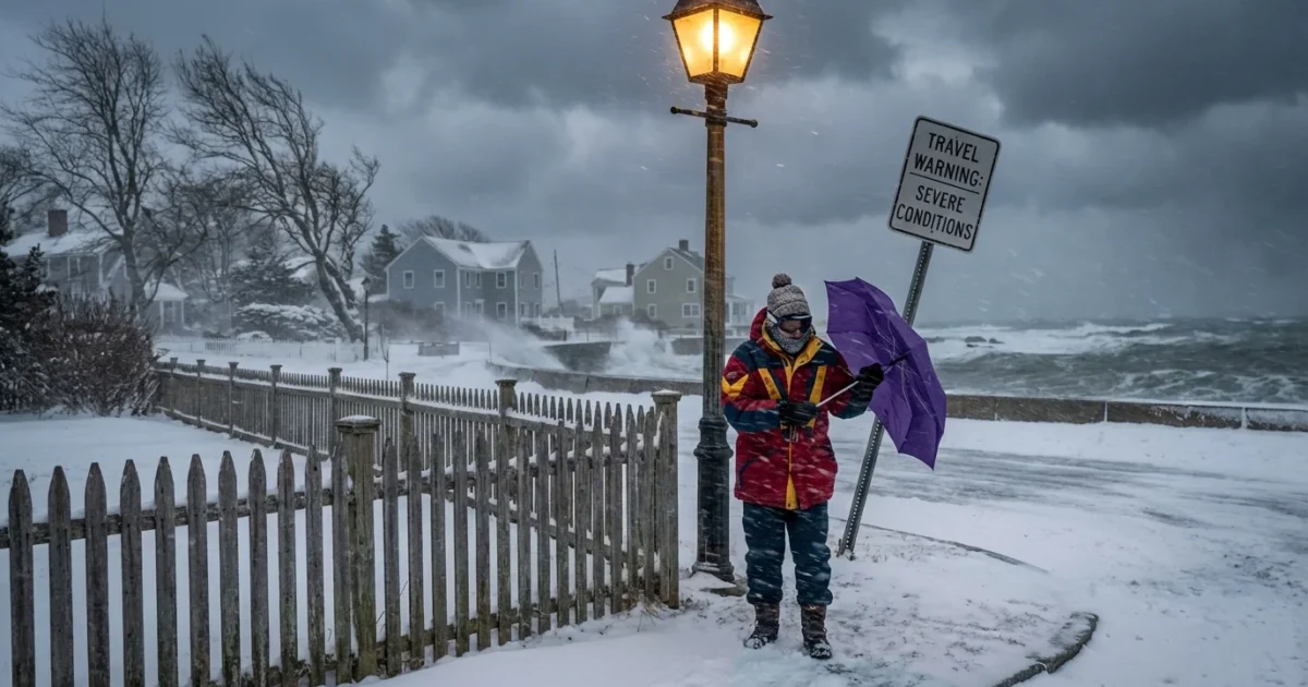
The first bands could reach the Mid Atlantic late Friday. Conditions worsen Saturday as the storm deepens and moves north. The most dangerous window looks like Saturday into Sunday, with the strongest winds and heaviest bands in that period. Travel delays and flight cancellations are likely where snow bands set up. Expect gusts that can exceed 40 to 50 miles per hour along exposed coasts and capes.
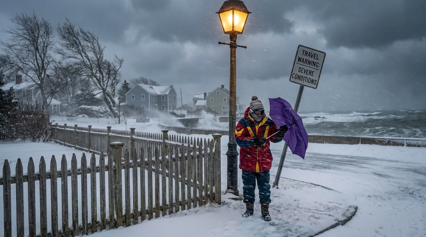
Coastal flooding is a growing concern. Elevated seas and strong onshore winds can stack water into bays and inlets. Watch the Saturday night and Sunday morning tide cycles. Ocean facing beaches will see high surf and erosion. Inland, roads may become slushy and then rutted as snow compacts.
The climate signal behind this storm
Warmer Atlantic waters add heat and moisture to winter storms. That boosts precipitation rates, a reason intense bands can form. Many recent winters have delivered wetter snow near the rain snow line, thanks to warmer air just above the surface. That creates the heavy, sticky snow that snaps branches.
Sea level rise adds to coastal flood risk. A moderate storm today can flood like a stronger one from decades ago. The jet stream pattern this week also fits a climate influenced world. Larger temperature contrasts and a wavier flow can favor sharp, fast developing systems. None of these factors guarantee the exact outcome, but they raise the ceiling on impacts.
What to do now
Confidence will sharpen 24 to 48 hours before the peak. Prepare now, adjust later. If you live along the coast, plan for wind, water, and possible road closures. If you live inland, plan for heavy, wet snow and outages. Keep travel flexible.
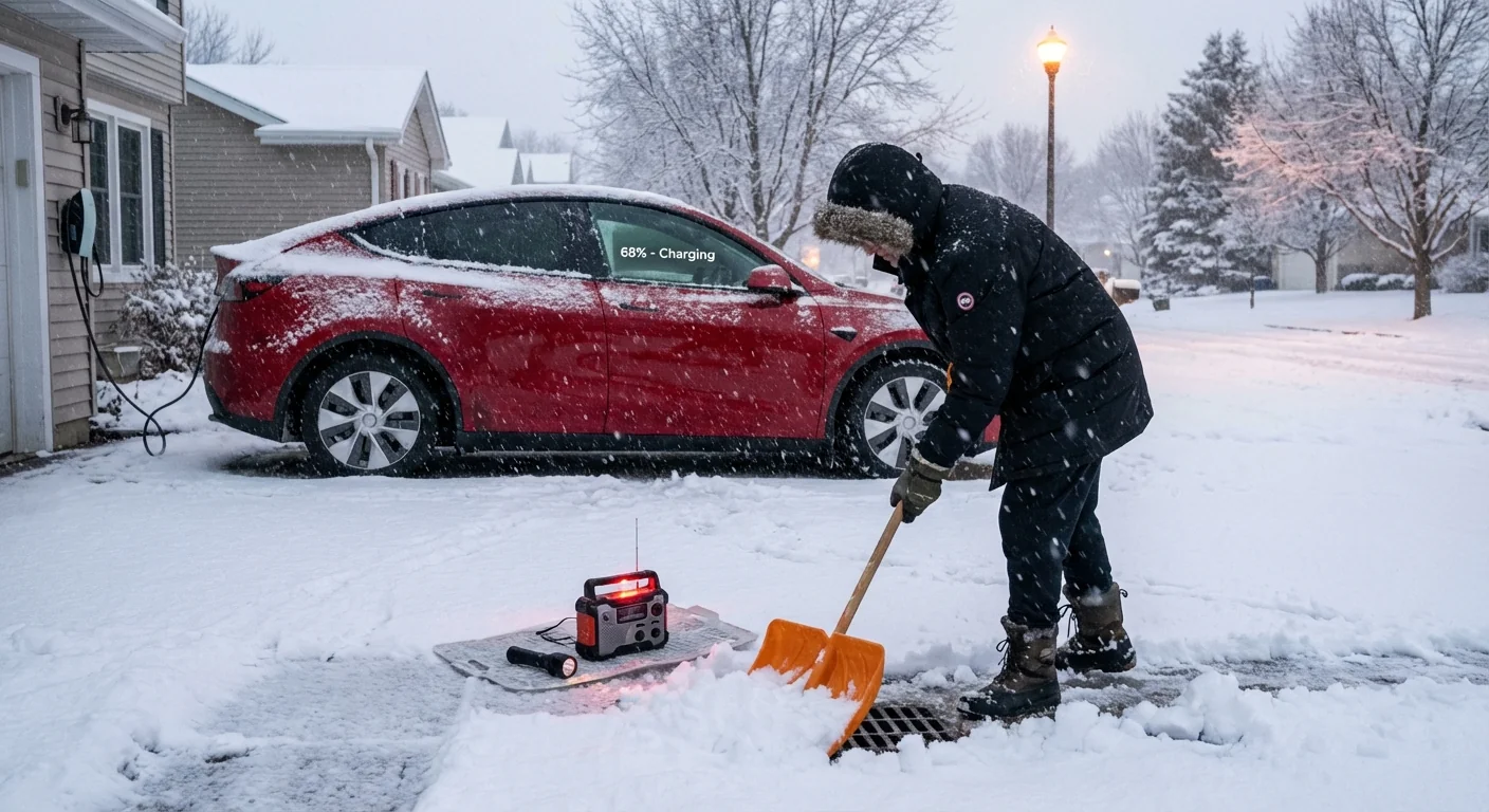
- Stock batteries, medicines, and a simple food plan for 48 hours.
- Charge phones and power banks. Check flashlights and weather radios.
- Clear storm drains and gutters. Move cars off flood prone streets.
- For EVs, precondition and keep range above 60 percent. For gas cars, keep at least a half tank.
Set wireless emergency alerts on your phone, and bookmark your local forecast office for updates.
Use transit if roads turn slick. If you must drive, slow down and leave space. Keep pets and outdoor gear secured. Secure trash bins, lawn items, and construction materials. In flood zones, move items to higher levels and plan your exit route before the tide peaks. Snow lovers, remember that heavy bands can change fast. Do not chase them into unsafe conditions.
The bottom line
A high impact coastal storm is on deck for this weekend. The exact track will decide who ends up with rain, heavy wet snow, or a mix. The worst looks likely Saturday into Sunday, with strong winds, dangerous seas, and pockets of coastal flooding. Warmer seas and higher baseline water levels add power and risk. I will keep tracking the shift zone and update the snow and wind footprint as confidence tightens. Plan now, stay flexible, and check back as the rain snow line sharpens. ❄️🌊


