A dangerous winter storm is tightening fast over the heart of the country. Atmospheric pressure is dropping quickly, turning this system into a classic “bomb cyclone.” Heavy snow, whiteout gusts, and treacherous ice are now likely across parts of the Midwest and Great Lakes. Warm air to the south adds a second threat, with severe thunderstorms and a few tornadoes possible. Travel plans are at risk. Power grids will be tested. This is a fast-moving, high-impact event.
What a bomb cyclone means, in plain terms
A bomb cyclone is a low pressure system that deepens very fast. The air pressure falls sharply, which tightens the wind field. That squeeze creates fierce gusts and drives heavy snow bands. The storm then feeds on temperature contrasts, like a winter engine. Cold Arctic air collides with moist, milder air from the south, and the result is intense lift and heavy precipitation.
In simple terms, the storm strengthens quickly, then throws snow sideways. That is how blizzards form, with whiteouts, drifting, and life-threatening wind chills.
Who is in the path right now
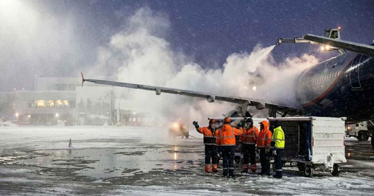
Snow is spreading across the Upper Midwest and Great Lakes, with the heaviest bands pivoting near the storm’s center. Blizzard conditions are likely where snow and wind overlap. Metro Detroit sits near a tight gradient, and is at risk for damaging winds, slick roads, and spotty power outages as the storm strengthens. Periods of heavy snow and brief whiteouts will be possible, especially as the low tracks east.
Farther south, the warm side of the storm is unstable. Severe thunderstorms can produce large hail, damaging straight line winds, and a few tornadoes. That threat rides the storm’s trailing front, then shifts east as the system lifts.
Air and road travel will be disrupted. Expect flight delays and cancellations as visibility drops and winds increase.
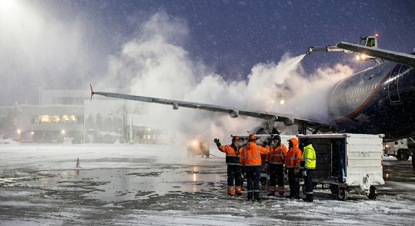
Whiteout conditions can start quickly and last for hours. Delay travel if you can. If you must go, tell someone your route and arrival time. ⚠️
Why this storm is supercharged
Our atmosphere is running on a stronger fuel mix. Warmer oceans add moisture to the air. That moisture is energy for storms. When Arctic air dives south and meets that moisture, snowfall rates can spike. The jet stream also swings more wildly in a warming climate, which can help spin up deep lows like this one.
The result is not more storms every day. It is sharper extremes when the setup aligns. Heavier bursts of snow. More freezing rain events near the rain snow line. Bigger wind fields that stress old power lines and brittle trees. We are seeing that play out in real time with this cyclone.
How to prepare in the next few hours
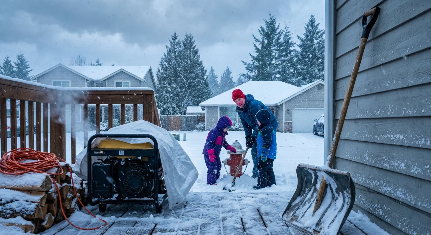
You still have time to make smart moves. Focus on heat, light, and safe travel. Charge devices. Park away from big limbs. Set your fridge and freezer a little colder to protect food if power blinks. If you have to drive, slow down and leave triple the normal distance.
Pack a simple storm go bag:
- Water, snacks, and needed medicines
- Phone chargers and a backup battery
- Warm layers, hats, gloves, and blankets
- Ice scraper, sand or cat litter, and a small shovel
- Top off your gas tank, or charge your EV to at least 80 percent.
- Check flashlights, batteries, and carbon monoxide detectors.
- Move generators outdoors, at least 20 feet from doors and windows.
- Clear snow from vents and hydrants as it falls, not just at the end.
Keep a small, steady drip on faucets if temperatures plunge. It lowers the risk of frozen pipes. ❄️
What I am tracking next
The storm will tighten further as it crosses the Great Lakes. Expect frequent gusts between 40 and 60 miles per hour near the core. Heavier snow bands will set up on the west and north sides, with rapid drops in visibility. In Metro Detroit, strongest winds are likely as the low passes, with a quick change in road conditions. A sharp temperature fall can create a flash freeze on wet pavement.
Power companies may see scattered to widespread outages where winds and snow combine. Crews will face dangerous conditions during peak gusts. If you lose power, bundle up, close interior doors, and avoid unsafe indoor heat sources.
Air travelers should check flight status early. Road travelers should watch for closures and drifting on open stretches. Plow teams will focus on main arteries first, then neighborhoods.
The bottom line
This is a high impact winter storm with a rare, fast deepening core. The mix of blizzard conditions to the north and severe storms to the south makes it a double threat. The climate signal is clear, warmer oceans and strong contrasts are supercharging events like this. Prepare now, move early, and keep your plans flexible. I will continue to track the core pressure, wind field, and banding zones, and will update as the storm evolves. Stay safe, check on neighbors, and give plows and line crews room to work.


