BREAKING: KCRG issues First Alert Day as blizzard conditions loom, while Cedar Rapids schools face an $11M shortfall
A double emergency, one urgent, one long-term
Eastern Iowa is bracing for a dangerous winter storm today. KCRG has issued a First Alert Day, signaling a serious threat to travel and safety. A Winter Storm Watch is up for parts of the region. Heavy snow, strong winds, and near whiteout conditions are possible. This is the kind of setup that shuts down roads fast.
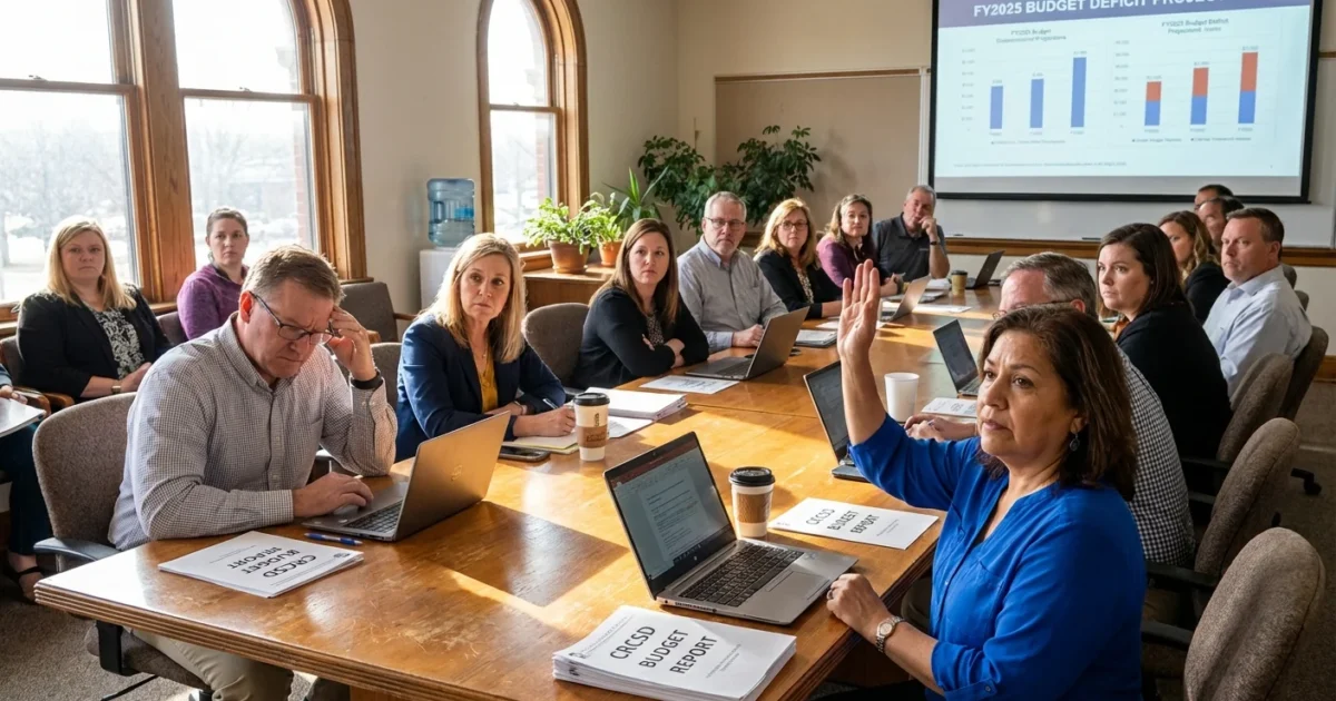
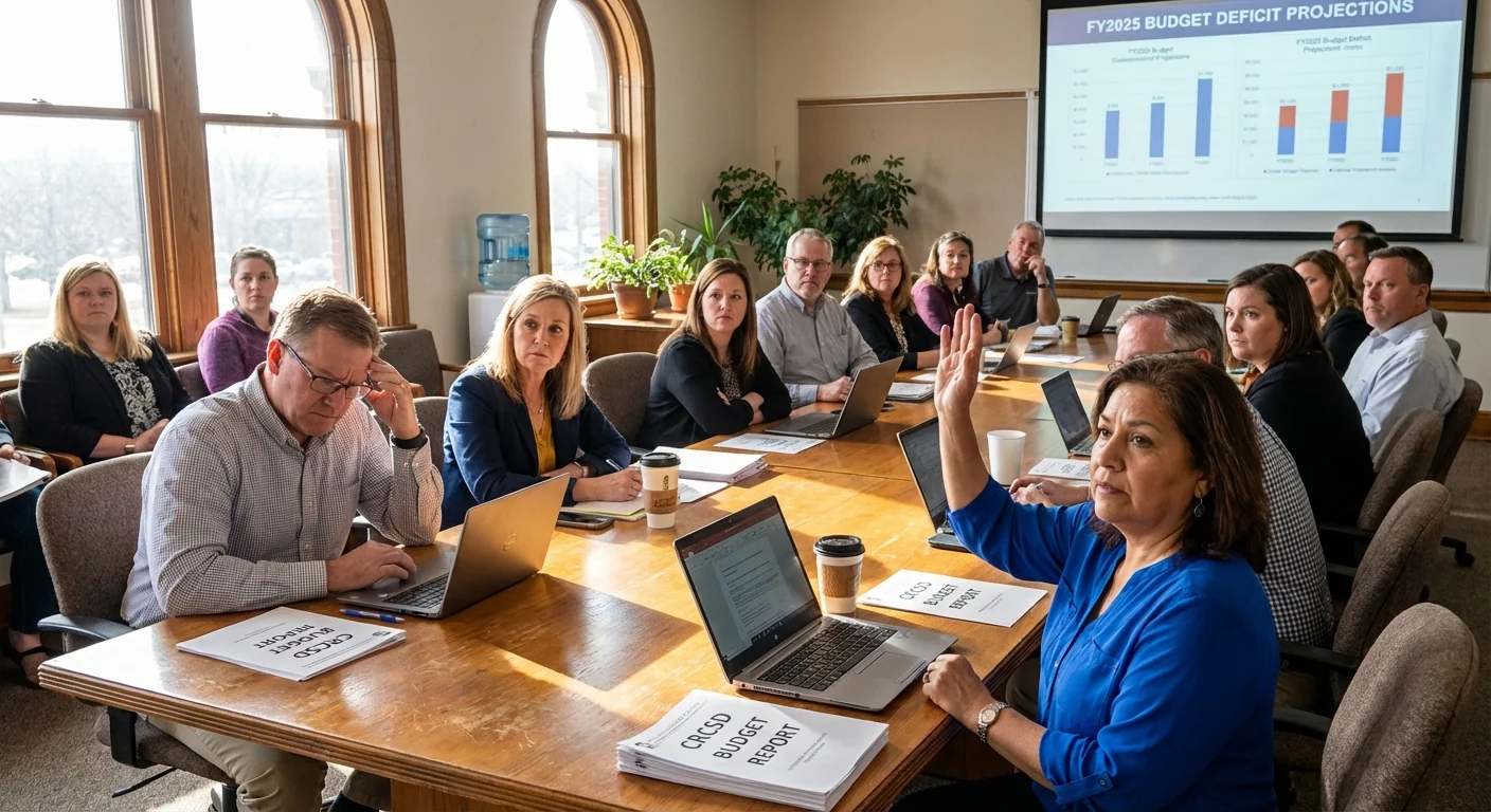
At the same time, the Cedar Rapids School District is staring at an 11 million dollar budget deficit. Families are watching the radar and the balance sheet. Both stories point to one reality. The weather is changing, and our systems are strained.
What the storm will do, and why it matters
The setup
Cold air is surging south. A strong low is riding along the jet stream, pulling Gulf moisture into the Midwest. That mix often means intense snowfall rates, quick drifts, and sudden visibility drops. Gusts could loft snow into the air for hours, even after flakes stop falling. Travel will be difficult, at times dangerous.
Expect the worst conditions when the heaviest snow bands line up with peak winds. Plows can help, but drifting snow can quickly cover cleared lanes again. Rural roads and open stretches will be hit hardest. If you must drive, plan like you might be delayed for a long time.
Whiteouts can arrive without warning. If you cannot see the road, pull off safely, keep flashers on, and wait it out.
The climate signal
Winters are warming in the Midwest. That does not mean less snow every year. Warmer air holds more moisture. When cold air returns, storms can wring out heavier snow in short bursts. This storm fits that pattern. Fast swings, more moisture, and higher odds of extreme impacts. Climate change is shifting the baseline, and we feel it in events like this.
How to stay safe today and ease pressure on the grid
Stay home if you can. If you need to be out, slow down and leave space. Think about your home energy use too. High demand in a storm can strain local systems. Small steps add up.
- Delay nonessential travel, and tell someone your route and timing
- Charge phones and battery packs before peak winds arrive
- Lower your thermostat a couple of degrees to reduce load, dress in layers
- Check on neighbors, especially seniors and those with medical needs
Keep a winter car kit ready. Include water, snacks, blankets, a flashlight, jumper cables, a shovel, and sand or kitty litter.
City crews and utility teams are preparing for outages and drifts. Give plows space. Never drive around a closed road sign. If your power goes out, report it and use flashlights, not candles. Never run generators indoors.
Storms cost money, and schools are feeling it
The Cedar Rapids School District reports an 11 million dollar shortfall. Leaders point to carry-over deficits, rising salaries, and fewer students. Weather plays a role too. Heating bills, storm closures, bus routes, and aging buildings all carry costs. When budgets tighten, the margin for safety and learning narrows.
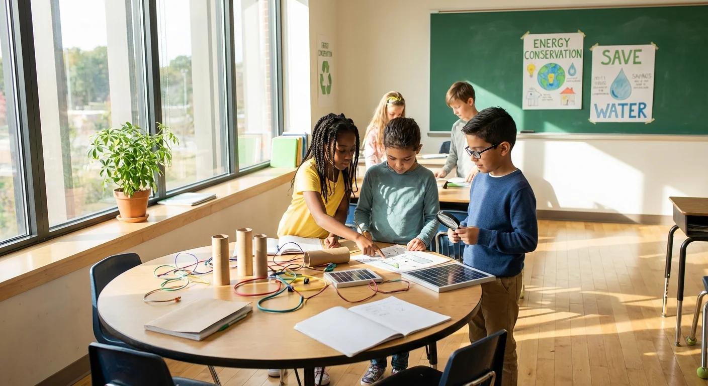
There is a path that helps both climate and costs. Energy efficiency upgrades can cut utility bills and reduce emissions. Better insulation, smart controls, LED lighting, and modern boilers save money year after year. Cleaner buses can lower fuel and maintenance costs.
Energy upgrades in schools often pay back within a few years. Savings can protect classroom programs while lowering carbon pollution.
How you can help, today and in the weeks ahead
- Follow official road and school alerts. Respect closures and delays.
- Attend the next school board meeting. Ask for a public energy audit and a savings plan.
- Support grant applications for efficiency and resilience projects.
- Volunteer for a community task force on student safety and sustainable facilities.
We need safe roads this week. We also need schools that can weather the next storm without breaking the bank.
What happens next
I will be tracking the snow bands and wind shifts through the day. If visibility drops to a quarter mile or less for several hours, blizzard conditions are likely. Expect rapid changes. A few miles can make the difference between wet roads and a whiteout. As the system exits, drifting may continue into the night. Cleanup will take time.
KCRG will continue First Alert Day coverage, and I will continue reporting on the district’s budget choices. The two stories connect. A safer, more efficient community is also a more resilient one.


