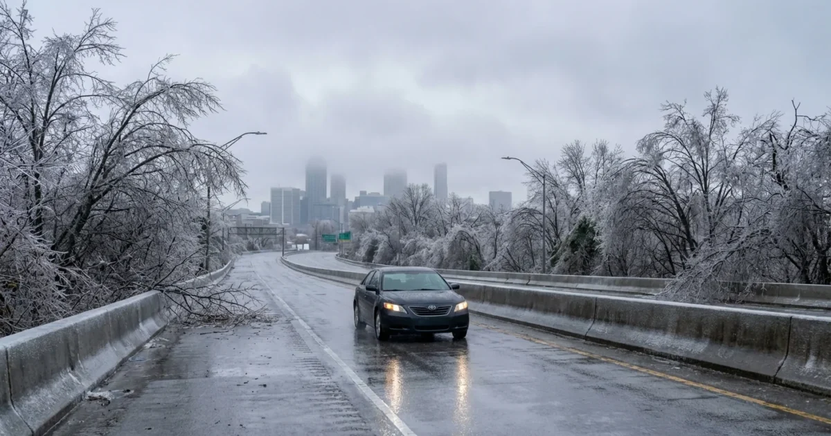
Atlanta braces for a hard hit of winter. A glaze of ice is possible across metro Atlanta and north Georgia this weekend. Freezing rain is on the table, which means slick roads, stressed trees, and scattered power outages. This is the setup we watch closely, and it has our full attention.
What the latest forecast shows
Cold air is pressing south and pooling near the ground. Warmer, moist air rides in above it. That is a classic recipe for freezing rain. Precipitation may start as cold rain. It can freeze on contact once surface temperatures slip to 32 degrees or lower. Timing remains uncertain, but the risk window targets late weekend. North and central Georgia, including the metro, face the highest chance for icing.
Bridges and overpasses will be the first trouble spots. They freeze faster than regular roads. Expect black ice, which looks like wet pavement and hides in the dark. Tree limbs can ice up and snap. Power lines can sag and fail if the glaze builds.
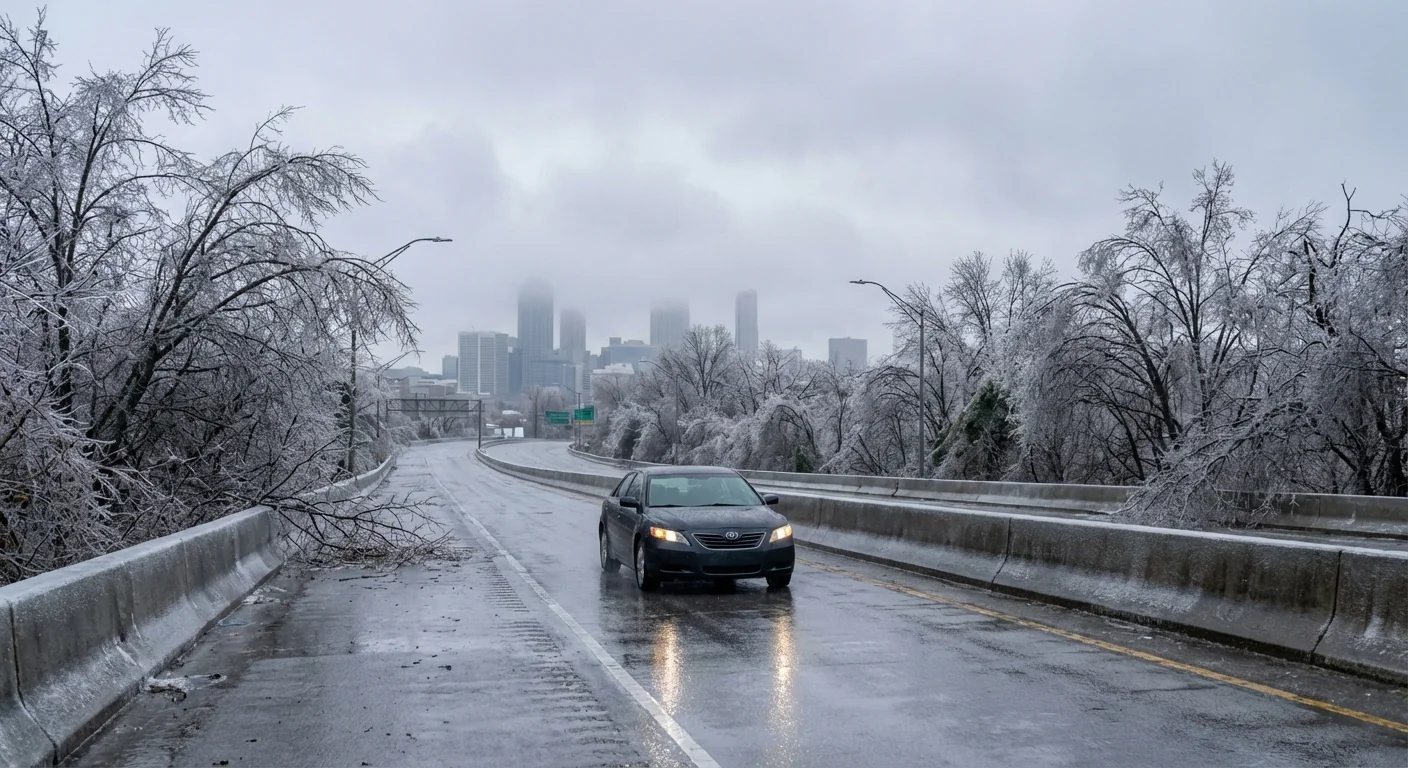
Travel could turn hazardous quickly if ice forms. Plan to delay trips once temperatures fall near freezing.
Why ice is the big risk
Sleet bounces. Snow packs. Ice sticks. A thin glaze can make a city halt. A quarter inch of ice can bring down limbs and lines, even without strong wind. The weight builds fast on trees with heavy canopies. In neighborhoods with older hardwoods, the risk is higher. Urban streets can stay a bit warmer from the heat island effect, but that help fades at night. Valleys and shaded corridors will coat first and thaw last.
This is winter in a warming world. Our winters trend milder on average, but the air now holds more moisture. When shallow cold does arrive, it can wring out icy storms. Fewer snow days, perhaps. More ice days when the pattern lines up like this.
How Georgia is mobilizing
Road crews are already moving. Brine trucks are pretreating major routes, ramps, and bridges. Crews are staged to sand and plow where needed. Utilities have tree teams and bucket trucks ready to roll. They are preparing for spotty outages if ice accretes on lines and feeders.
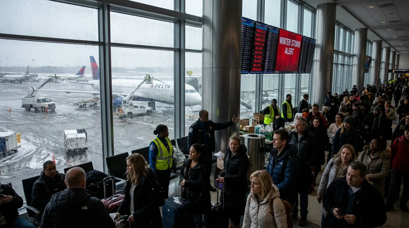
Emergency managers are lining up supplies and staffing. Warming centers can open fast if needed. Airports, schools, and event venues are monitoring for schedule changes. If the glaze materializes, expect delays and cancellations to ripple across the weekend.
What you should do now
Act today, before the first drops freeze. A few simple steps will reduce risk and stress.
- Charge phones, laptops, and battery banks. Top off car gas or EV charge.
- Build a 48 hour kit, water, shelf food, flashlights, meds, pet needs.
- Prepare heat backups, extra blankets, layered clothing, safe space heaters.
- Stay off roads during icing. If you must drive, go slow and avoid sudden braking.
- Move cars off streets under big limbs. Clear gutters and secure loose items.
Set your thermostat a degree lower, close blinds, and seal drafts. You will stay warm longer and reduce strain on the grid.
Never use a grill or generator inside a home, garage, or near windows. Carbon monoxide is deadly and invisible.
If the power goes out, unplug sensitive electronics. Keep refrigerator doors closed. Check on neighbors, especially older adults and those with medical needs. Report downed lines and avoid any wire on the ground.
Climate context and resilience
Icing events test our systems. More moisture in a warming climate can load storms with extra energy. When a shallow cold dome slides in, that moisture becomes glaze. The recipe is subtle, but the impact is sharp. We can adapt. Bury more neighborhood power lines where possible. Trim trees with climate smart practices to protect our urban canopy. Use permeable pavements and improved drainage to limit refreeze. Upgrade building efficiency so homes hold heat during outages.
Households can help too. Weatherize doors and windows. Switch to LED bulbs. Stagger appliance use during storm peaks to reduce grid load. Keep an emergency kit stocked year round. A prepared city is a safer, cleaner city.
The bottom line
Atlanta faces a real ice threat this weekend. The exact timing and totals are still in flux, but the signal is strong enough to act now. Roads can turn slick in minutes, trees can fail under a thin glaze, and power can blink. Prep today, travel smart, and stay alert for updated watches and warnings. We will keep watching the sky and the sensors, and we will keep you ahead of the storm. Stay safe, stay ready, and check in on each other.


