Breaking: A powerful Arctic cold front is racing south and east today, setting the stage for a dangerous winter storm late week into the weekend. Ice, snow, and bitter wind chills are on the table from Texas to the Mid-Atlantic. I am tracking a colder setup than recent systems, and the risk of icing is rising, especially across parts of the South. Small shifts in the storm track and in temperatures near freezing will make a big difference. Here is what you need to know now. ❄️
The setup: Arctic air meets Gulf moisture
A deep dip in the jet stream is unlocking very cold air from the Arctic. That air is pressing into the Plains and the South. At the same time, warmer, wetter air is trying to flow in from the Gulf of Mexico. Where those air masses meet, clouds thicken and precipitation forms.
This pattern favors a mix of snow, sleet, and freezing rain along and just north of the front. In Texas and nearby states, a shallow cold layer near the ground may undercut a thin warm layer a few thousand feet up. That warm layer can melt falling snow into drops. If surface temperatures sit at or below 32 degrees, those drops freeze on contact. That is how you get glaze ice on roads, trees, and power lines.
Who is in the path, and when
Confidence has improved that winter weather arrives late week into the weekend. Exact timing will vary by region. Expect a plow of Arctic air first, then waves of wintry precipitation on its cold side.
- Texas, Oklahoma, Arkansas: Late Friday through Saturday, highest risk for sleet and freezing rain.
- Lower Mississippi Valley and Gulf states: Late Friday night through Saturday, periods of ice or a wintry mix.
- Tennessee Valley and southern Appalachians: Saturday into early Sunday, mix changing to snow in colder areas.
- Mid-Atlantic and I‑95 corridor: Saturday night into Sunday, snow or a rain to snow change, track dependent.
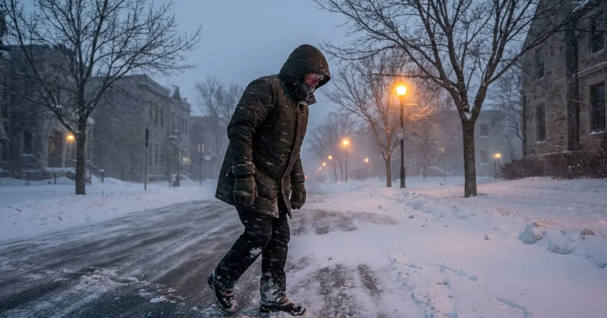
Wind chills will be dangerous behind the front. Some areas may feel like the single digits or teens, even where air temperatures are higher.
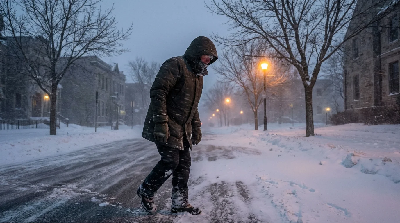
Icing is the top threat across parts of Texas and the South. A quarter inch of ice can bring down limbs and cause power outages. Even a thin glaze can turn bridges and overpasses into skating rinks. Travel could become hazardous in hours, not days.
Why this storm is different
This time, the cold arrives first and it is deeper. That undercuts the storm with a colder base. Models are converging on a solution that keeps the freezing line south of normal for midwinter. That boosts the chance of ice in the South and snow farther north.
The track of the main low matters. If the low hugs the Gulf Coast, cold air wins inland, and ice or snow spreads farther south. If the low tucks inland toward the Appalachians, warmer air noses in aloft, and icing risks jump along the front. A coastal track near the Southeast coast could favor heavier snow bands into parts of the Mid-Atlantic. A shift of 50 to 100 miles can flip rain to ice or snow, and back again.
Climate context: Cold outbreaks in a warming world
A warming climate does not end winter storms. It can reshape them. The atmosphere now holds more moisture, which can feed heavier precipitation. When cold air is in place, that can mean bigger snow totals. When temperatures hover near freezing, it can mean more sleet and freezing rain.
Arctic regions are warming faster than the globe. That reduces the contrast between the poles and the mid-latitudes. Some research links this to a wavier jet stream at times. A wavier jet can help dislodge cold air southward, then lock it in. Meanwhile, cities run warmer than rural areas, which can shift who sees snow, who sees rain, and who gets ice. Infrastructure, especially the grid and water systems in the South, remains vulnerable to rare but severe freezes. Planning for resilience is climate adaptation in real time.
How to prepare, with sustainability in mind
Prepare now, while the forecast sharpens. Focus on safety, heat, and reducing strain on the grid.
- Charge devices and back up critical power, then lower thermostats a few degrees to ease demand.
- Weatherstrip doors and cover drafty windows to keep heat in and energy use down.
- Protect pipes with insulation, let faucets drip in the coldest hours to prevent bursts.
- Trim small weak branches near lines where safe, and park away from large limbs.
- Use sand or eco-friendly deicers on steps and driveways to protect waterways.
Plan travel for the warmest part of the day, and avoid bridges and overpasses when temperatures are near freezing. Keep a winter kit in the car with water, snacks, blankets, and a scraper.
Never run generators, grills, or cars in garages. Check furnace and dryer vents for snow and ice. Carbon monoxide is odorless and deadly.
The bottom line
A sharp Arctic front is priming a weekend winter storm with a high risk of ice in parts of Texas and the South, and snow or a mix into the Mid-Atlantic. The cold is deeper, the moisture is ready, and small track shifts will decide who gets what. I am updating timing and impacts through the day. Monitor local National Weather Service alerts, and act now so you can ride out the freeze safely and sustainably.


