BREAKING: Arctic blast triggers widespread snow, dangerous cold, and a fast weekend storm
Winter has seized control. An intense Arctic front has dropped temperatures 20 to 40 degrees below normal across much of the nation. Up to 105 million people are feeling this cold today. Subzero lows and single digits will grip parts of the Midwest and East through the weekend. The cold is the setup. The snow is next.
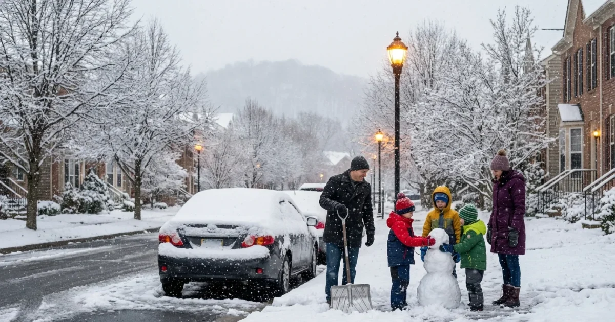
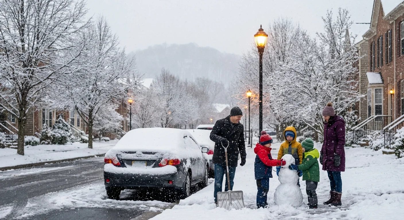
A fast, compact storm is racing from the Plains toward the Mid-Atlantic and Northeast. Most spots will see 1 to 4 inches. Some communities in the mountains will see much more. Southern Connecticut, Long Island, and coastal New England are on track for the season’s first measurable snow Sunday morning. Parts of Virginia, Maryland, and nearby states are facing a second snow in a week, with rates near one inch per hour at times. Travel will be slick, and school and event plans may change fast.
What is driving this pattern
Arctic air has poured south behind a sharp front. This cold air is dense and heavy, so it undercuts warmer air. That lift helps clouds thicken and snow grow. Several fast clipper systems are sliding along the jet stream from the northern Plains to the coast. Clippers are quick and can surprise drivers, even with light totals.
A lobe of the polar vortex is sitting nearby, not overhead. That keeps the air very cold and unstable. If it shifts and meets incoming Pacific moisture, a coastal low could form. That would boost snow along the I‑95 corridor. This risk is real, but still uncertain.
Model guidance supports a coastal low only if the cold core aligns with Atlantic moisture. Check updates every 6 to 12 hours.
From a climate view, a warming world still allows sharp cold shots. Sea ice changes and a wavier jet can unlock Arctic air. Warmer oceans also add moisture. When cold and moisture overlap, snow can be intense, even if brief.
Timing and impacts by region
Light snow and bands of heavier bursts will move east in waves. Expect changing conditions over short distances.
- Upper Midwest and Great Lakes, today into Saturday, light to moderate snow, with lake effect squalls. Whiteouts near the lakes.
- Ohio Valley to central Appalachia, Saturday, a quick 2 to 4 inches, with localized 5 inches in higher terrain.
- Mid-Atlantic, Saturday afternoon into Saturday night, 3 to 5 inches possible from western and central Virginia into Maryland and nearby states. Some roads may ice over.
- Southern New England and Long Island, predawn to midday Sunday, 1 to 3 inches likely, including southern Connecticut’s first measurable snow of the season.
Gusts could hit 40 to 50 mph on exposed ridges. That means blowing snow and brief, blizzard-like conditions. Pockets of freezing rain are possible on the southern edge of the snow shield. Small temperature changes will decide if you see snow, sleet, or glaze.
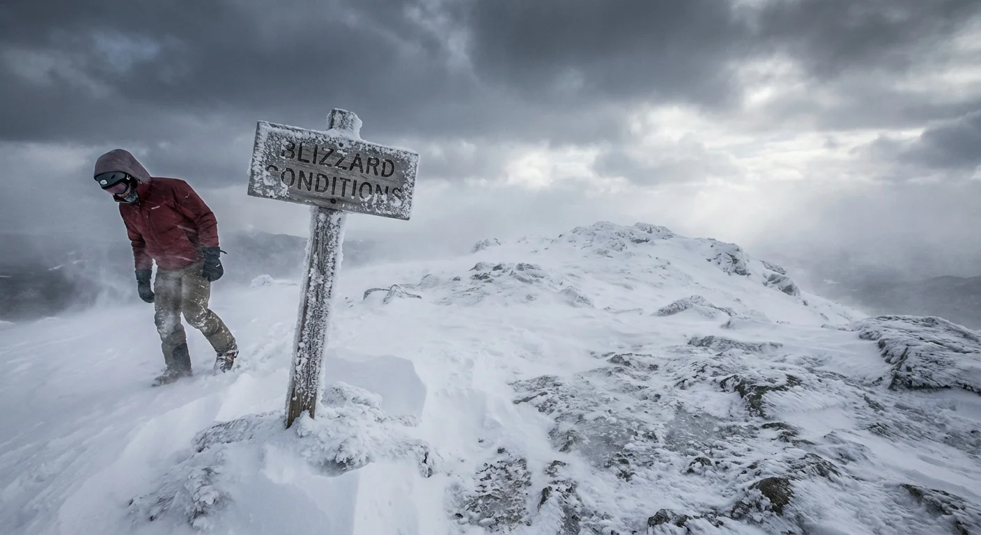
Wind chills will drop well below zero in the Upper Midwest and interior Northeast. Frostbite can begin in minutes on exposed skin.
How to prepare and travel safely
Cold plus quick snow is a high impact mix. Treat today like a winter drill, with real stakes.
- Slow down, leave extra stopping space, and clear all windows and lights.
- Pack a car kit, flashlight, blanket, battery pack, and sand or kitty litter.
- Heat safely, check smoke and carbon monoxide alarms, and never use generators indoors.
- Conserve energy during peak hours, lower thermostats a few degrees, and seal drafts.
If you must travel, plan around the heaviest bands, and share your route with a friend. Fill the tank and charge phones.
What could change next
There is a credible chance of a stronger coastal low late Sunday into Monday if the polar vortex lobe shifts east. That could push heavier snow toward New York City, Providence, or Boston. It could also move offshore and spare the coast. Small track and temperature shifts will make a big difference on the rain or snow line. I will track the jet stream alignment and surface pressure falls along the Mid-Atlantic coast. Those signs would point to rapid intensification.


