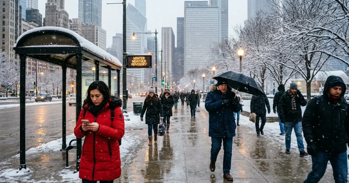
Breaking now, a Winter Weather Advisory has been expanded across the Chicago metro as a snow producer closes in tonight. Expect light to moderate snow that slicks roads, slows traffic, and cuts visibility. Then, a sharp cold blast drops in behind it, turning slush to ice and driving wind chills down by Friday and into the weekend. Your evening and Friday morning plans need a reset.
What the advisory means for your commute
Snow returns this evening and will be steady enough to make travel tricky. Road surfaces are cold, so snow will stick fast on untreated lanes. Plows and salt trucks will be out, but early bands can get ahead of crews for a few hours.
Lake Michigan can add extra moisture, especially near the city and along the North Shore. That may enhance bursts at times. Visibility can fall quickly in these bands. If you have a late work shift, a school event, or airport pickup, give yourself extra time.
Expect changing conditions block by block. A clear stretch can become slick and snowy in minutes, especially near the lake and open fields.
Timeline at a glance
- This evening, first flakes spread west to east during the dinner hours. Roads become slick after the first hour of snow.
- Late evening to after midnight, light to moderate snow continues, with bursts that drop visibility. Side streets and bridges ice up first.
- Pre-dawn into the Friday morning commute, lingering snow tapers, but roads stay slick. Watch for black ice and refreeze.
- Friday afternoon and night, winds turn colder. Temps fall, slush hardens, and wind chills dip toward or below zero.
Why this is happening
A compact low is sweeping in from the Plains, pulling moist air over our colder surface layer. That setup favors quick, efficient snowfall in the city and suburbs. The jet stream dips just enough to pull a shot of Arctic air in behind the storm. That is the cold blast set to lock in Friday and over the weekend.
Chicago’s winters are warming over the long term, but that does not remove sharp cold snaps. A warmer atmosphere can hold more water. When a storm lines up with just enough cold, it can still deliver solid bursts of snow. Then the door swings open to the north, and the cold pours in. That back and forth, warm then cold, is a growing winter pattern here. It boosts freeze and thaw cycles, which chew up roads and drive salt use.
How to get ready, the smart and sustainable way
If you must drive, slow down and leave more room. Top off washer fluid and check tires. Keep your phone charged. Transit riders should plan for some delays and dress for longer waits on platforms.
Shovel early and often, so you use less salt. Salt works best near freezing and much less in deep cold. Aim for a light hand to protect pets, waterways, and your driveway. Sand or grit adds traction without melting runoff into streams.
Layer up, cover hands and head, and bring a spare pair of dry socks. Clear storm drains before the freeze to prevent icy puddles later.
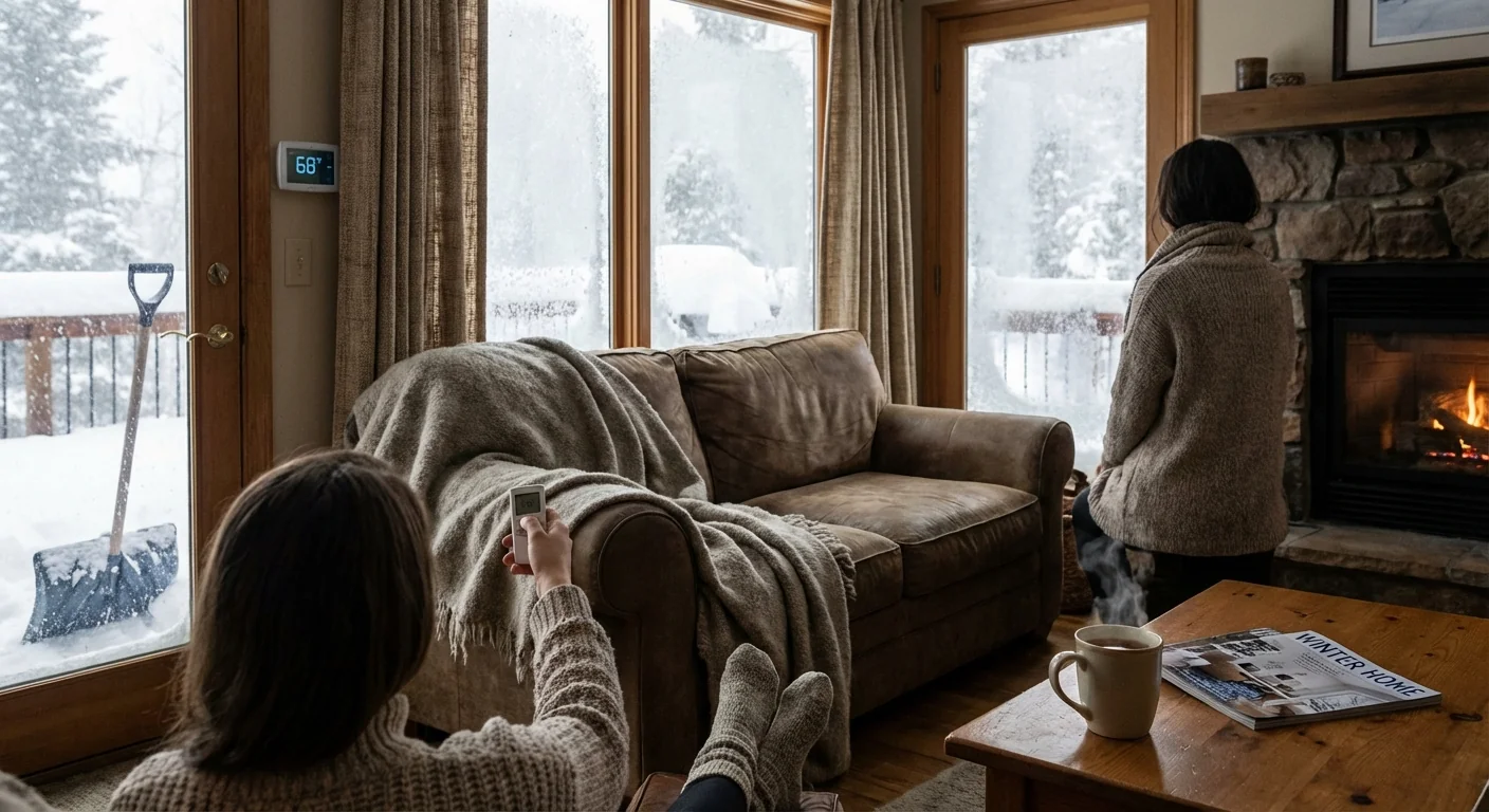
Households can prep for the cold shot now. Set faucets to a slow drip overnight in drafty spots to protect pipes. Check furnace filters and seal window drafts with towels if needed. Bring pets inside. Check on neighbors who may need a hand.
What comes after the snow
Friday brings a fast drop in temperatures. Any slush from tonight will freeze hard. Even midday travel can feel harsh with the wind. After dark, wind chills will bite, especially in open areas and near the lakefront where wind funnels along buildings.
Energy demand will jump as furnaces run longer. If you can, lower your thermostat one or two degrees, close doors to unused rooms, and use heavy curtains at night. Small steps help the grid and your bill. Keep exhaust vents clear of snow to prevent carbon monoxide buildup.
City crews will keep working through the event, but refreeze is the challenge once the cold arrives. Expect slick overpasses, ramps, and shaded side streets into Saturday. If the wind lines up with the lake, brief lake effect bursts could redevelop near the shore, keeping conditions variable.
The bottom line
Snow tonight, slow travel, then a fast flip to deep cold. Plan a safer commute, dress for a bite in the wind, and use less salt to protect our waterways. Keep an eye on official updates for timing tweaks as the bands move in. Chicago knows how to do winter, but this one will hit in two waves. Prepare now and you will move through it with confidence. ❄️


